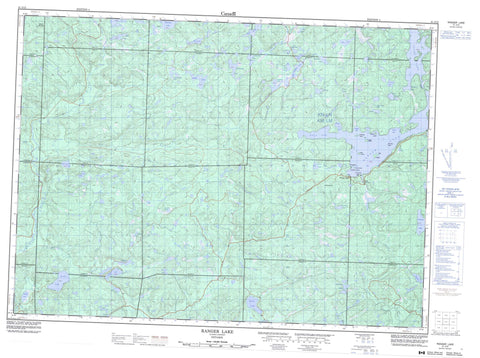
041J13 Ranger Lake Canada topo map, 1:50,000 scale
041J13 Ranger Lake NRCAN topographic map.
Includes UTM and GPS geographic coordinates (latitude and longitude). This 50k scale map is suitable for hiking, camping, and exploring, or you could frame it as a wall map.
Printed on-demand using high resolution, on heavy weight and acid free paper, or as an upgrade on a variety of synthetic materials.
Topos available on paper, Waterproof, Poly, or Tyvek. Usually shipping rolled, unless combined with other folded maps in one order.
- Product Number: NRCAN-041J13
- Parent Topo: TOPO-041J
- Map ID also known as: 041J13, 41J13
- Unfolded Size: Approximately 26" high by 36" wide
- Weight (paper map): ca. 55 grams
- Map Type: POD NRCAN Topographic Map
- Map Scale: 1:50,000
- Geographical region: Ontario, Canada
Neighboring Maps:
All neighboring Canadian topo maps are available for sale online at 1:50,000 scale.
Purchase the smaller scale map covering this area: Topo-041J
Spatial coverage:
Topo map sheet 041J13 Ranger Lake covers the following places:
- Camp Ten Bay - Indian Bay - Racquer's Bay - Vielles Bay - West Arm - The Dardanelles - 196 - 202 - 22,10 - 22,11 - 22,12 - 23,10 - 23,11 - 23,12 - 24,11 - 24,12 - 3G - 3H - 4G - 4H - 5G - 5H - Algoma - Curtis - Cuthbertson - Dablon - Daumont - Gaudette - Hodgins - Hughes - Hurlburt - Hynes - Jollineau - Lamming - LaVerendrye - Lunkie - McIlveen - Menard - Nahwegezhic - Pine - Reilly - Snow - Whitman - Big Island - Crane Island - Lewis Island - Mary Baily Island - Mattress Island - Moss Island - Old Maid Island - Savage Island - Sawdust Island - Amy Lake - Boat Lake - Boot Lake - Boundary Lake - Buck Lake - Channel Lakes - Cox Lake - Cruelface Lake - Deckers Lake - Deil Lake - Devil's Lake - Donut Lake - Fork Lake - Franks Lake - Garden Lake - Golf Lake - Hargraft Lake - High Lake - Lac Cherie - Laughing Lake - Laurence Lake - Little Loon Lake - Little Saddle Lake - Little Sand Lake - Magrath Lake - McWater Lake - Morrison Lake - Neganoban Lake - Nod Lake - Packsack Lake - Paquette Lake - Penelope Lake - Portage Lake - Raffle Lake - Ranger Lake - Red Pine Lake - Redpine Lake - Rod Lake - Saddle Lake - Saymo Lake - Seal Lake - Shewfelt Lake - Small Island Lake - Square Lake - Stag Lake - Tracy Lake - Trap Lake - Trapper Lake - Truck Lake - Upper Laughing Lake - Vixen Lake - Ward Lake - West Horseshoe Lake - Whitman Lake - Ogidaki Mountain - Goulais River Provincial Park - Jollineau Conservation Reserve - La Verendrye/Ogidaki Conservation Reserve - Campus Creek - Cherie Creek - Dam Creek - East Goulais River - Garden River - Goulais River - Gratton Creek - Icewater Creek - Laughing Creek - Little Garden River - Morrison Creek - Vaporem Creek - Whitman Creek - Ranger Lake


