
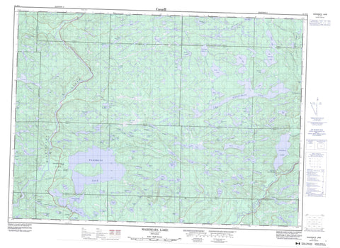
041J11 Wakomata Lake Canada topo map, 1:50,000 scale
041J11 Wakomata Lake NRCAN topographic map.
Includes UTM and GPS geographic coordinates (latitude and longitude). This 50k scale map is suitable for hiking, camping, and exploring, or you could frame it as a wall map.
Printed on-demand using high resolution, on heavy weight and acid free paper, or as an upgrade on a variety of synthetic materials.
Topos available on paper, Waterproof, Poly, or Tyvek. Usually shipping rolled, unless combined with other folded maps in one order.
- Product Number: NRCAN-041J11
- Parent Topo: TOPO-041J
- Map ID also known as: 041J11, 41J11
- Unfolded Size: Approximately 26" high by 36" wide
- Weight (paper map): ca. 55 grams
- Map Type: POD NRCAN Topographic Map
- Map Scale: 1:50,000
- Geographical region: Ontario, Canada
Neighboring Maps:
All neighboring Canadian topo maps are available for sale online at 1:50,000 scale.
Purchase the smaller scale map covering this area: Topo-041J
Spatial coverage:
Topo map sheet 041J11 Wakomata Lake covers the following places:
- Pig Pen Chute - 168 - 169 - 175 - 176 - 182 - 188 - 195 - 196 - 1C - 1D - 1E - 1F - 2C - 2D - 2E - 2F - 4G - Albanel - Algoma - Casson - Cuthbertson - Dagle - Gould - Grasett - Haughton - Jackson - Kamichisitit - LeCaron - Nouvel - Otter - Reilly - Rioux - Sayer - Shingwaukonce - Simons - Slievert - Sturgeon - Varley - Wagg - Aikens Lake - Arthur Lake - Assinamish Lake - Baird Lake - Barr Lake - Bayview Lake - Beaverkit Lake - Beilhartz Lake - Big Horseshoe Lake - Big Trout Lake - Bijou Lake - Black Lake - Blinko Lake - Blue Heaven Lake - Bluebird Lake - Bond Lake - Boot Lake - Bridge Lake - Brown Lake - Bull Lake - Burden Lake - Burns Lake - Burtt Lake - Camp Forty One Lake - Cashen Lake - Castra Lake - Chain Lake - Checkmark Lake - Cheney Lake - Chub Lake - Conacher Lake - Curve Lake - Damn Lake - Deadtree Lake - Delaney Lake - Dobie Lake - Dougall Lake - Duck Lake - Duval Lake - Dyment Lake - East Caribou Lake - East Twin Lake - Echo Lake - Elbow Lake - Ellis Pond - Endikai Lake - Farrel Lake - Faultside Lake - Finn Lake - Footprint Lake - Frobel Lake - Grasett Lake - Green Lake - Grindstone Lake - Harten Lake - Highland Lake - Hoover Lake - Horseshoe Lake - Huston Lake - Hyslop Lake - Izaak Lake - Jess Lake - Jimmy Lake - Jobammageeshig Lake - Kirk Lake - Kirkpatrick Lake - Lafoe Lake - Little Lafoe Lake - Long Lake - McEachern Lake - McGrath Lake - Mills Lake - Mistaken Lake - Moose Lake - Mud Lake - Murphy Lake - Murray Lake - Narrow Lake - Narvik Lake - Onedee Lake - Papineau Lake - Pearl Lake - Pineland Lake - Pipe Lake - Pointer Lake - Portage Lake - Puddingstone Lake - Rackey Lake - Raven Lake - Regal Lake - Robb Lake - Rockcliff Lake - Rogers Lake - Roothouse Lake - Rowe Lake - Saunders Lake - Seven Camp Lake - Seymour Lake - Shingwak Lake - Skirl Lake - Slash Lake - Snowbird Lake - Spot Lake - Stover Lake - Stringer Lake - Stull Lake - Swamp Island Lake - Swanson Lake - Teepee Lake - Threecorner Lake - Toodee Lake - Topsy Lake - Town Line Lake - Triple Isle Lake - Two Camp Lake - Upper Grindstone Lake - Urquhart Lake - Varley Lake - Wakomata Lake - Walsh Lake - Waterhole Lake - Wawiyay Lake - West Twin Lake - White Bear Lake - Wigwam Lake - Wigwas Lake - Wilson Lake - Little White River Provincial Park - Snowshoe Flats - Bijou Creek - Bond Creek - Bull Creek - Caribou Creek - Dougall Creek - Duval Creek - Grindstone Creek - Lafoe Creek - Little Lafoe Creek - Little White River - Mississagi River - Rapid River - Skintent Creek - Snowshoe Creek - Two Camp Creek - West Little White River - Wood Creek - Blind River - Gros Cap - Patten Post


