
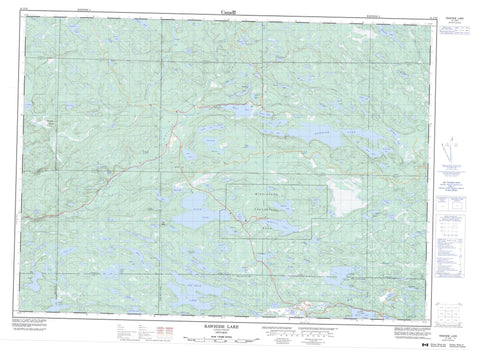
041J10 Rawhide Lake Canada topo map, 1:50,000 scale
041J10 Rawhide Lake NRCAN topographic map.
Includes UTM and GPS geographic coordinates (latitude and longitude). This 50k scale map is suitable for hiking, camping, and exploring, or you could frame it as a wall map.
Printed on-demand using high resolution, on heavy weight and acid free paper, or as an upgrade on a variety of synthetic materials.
Topos available on paper, Waterproof, Poly, or Tyvek. Usually shipping rolled, unless combined with other folded maps in one order.
- Product Number: NRCAN-041J10
- Parent Topo: TOPO-041J
- Map ID also known as: 041J10, 41J10
- Unfolded Size: Approximately 26" high by 36" wide
- Weight (paper map): ca. 55 grams
- Map Type: POD NRCAN Topographic Map
- Map Scale: 1:50,000
- Geographical region: Ontario, Canada
Neighboring Maps:
All neighboring Canadian topo maps are available for sale online at 1:50,000 scale.
Purchase the smaller scale map covering this area: Topo-041J
Spatial coverage:
Topo map sheet 041J10 Rawhide Lake covers the following places:
- Elliot Lake - Ceolin Falls - 144 - 145 - 150 - 151 - 156 - 157 - 162 - 163 - 168 - 169 - 1A - 1B - 1C - 2A - 2B - 2C - Albanel - Algoma - Beange - Bouck - Buckles - Hembruff - Hughson - Jogues - Kamichisitit - Landriault - LeCaron - Nicholas - Piche - Poulin - Q - R - Raimbault - Sagard - Slievert - Thorp - Tweedle - U - V - Vance - Viel - Kee Island - Knowles Island - Puhky Island - Alexander Lake - Applesauce Lake - Astonish Lake - Beaver Lake - Beavertail Lake - Bevans Lake - Big Lake - Bilton Lake - Birthday Lake - Block's Pond - Blue Sky Lake - Bobowash Lake - Bolger's Lake - Book Lake - Bruce Lake - Brush Lake - Brush Lakes - Bud Lake - Burnt Lake - Cabin Lake - Cabin Lake - Cedar Lake - Center Lake - Christman Lake - Cobre Lake - Crazy Lake - Crystal Lake - Distant Lake - Dollyberry Lake - Dougall Lake - Dunlop Lake - Duthorne Lake - Ezma Lake - Flack Lake - Frayn Lake - Fullerton Lake - Gaff Lake - Gashen Lake - Geiger Lake - Gibberry Lake - Gravelpit Lake - Grebe Lake - Grey Trout Lake - Hammer Lake - Hat Lake - Helenbar Lake - Iron Lake - Jim Christ Lake - Keelor Lake - Kyle Lake - Lake Twentythree - Larry Lake - Lillybet Lake - Lilypad Lake - Little Cedar Lake - Little Quirke Lake - Little Sister Lake - Location Lake - Lolligag Lake - Long Lake - Lower Mace Lake - Lucas Lake - Mace Lake - Manfred Lake - Maryfield Lake - Mayfield Lake - McElrea Lake - Mikel Lake - Minnow Lake - Moccasin Lake - Moon Lake - Mount Lake - Mud Lake - Oak Lake - Olympus Lake - Ompa Lake - Otter Lake - Peace Lake - Pear Lake - Pike Lake - Polar Bear Lake - Pour Lake - Quirke Lake - Rawhide Lake - Reception Lake - Red Lake - Reed Lake - River Lake - Rochester Lake - Rooster Lake - Rosemarie Lake - Rottier Lake - Sam Lake - Samreid Lake - Scarbo Lake - Semiwite Lake - Sister Lake - Skunk Lake - Speckle Lake - Square Lake - Stag Lake - Stewleen Lake - Strike Lake - Surefire Lake - Survey Lake - Swamp Lake - Teardrop Lake - Tee Lake - Ten Mile Lake - Tenfish Lake - Toobee Lake - Triangle Lake - Upper Mace Lake - Uranium Lake - Vasseau Lake - West Ritchie Lake - White Pine Lake - Wilkie Lake - Winchester Lake - Windy Lake - Wolf Lake - Boland Hill - Old Baldy - Blind River Provincial Park - Mississagi Provincial Park - Our Colleagues Conservation Reserve - Rawhide Lake Conservation Reserve - Boland River - Dougall Creek - Duval Creek - Kindiogami River - Little White River - Quirke Creek - Red Deer Creek - Rochester Creek - Serpent River - Shoe Creek - Sister River - Skunk Creek - Stag Creek - West Little White River - Blind River - Douglas Marsh


