
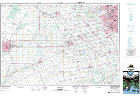
040P07 Stratford Canada topo map, 1:50,000 scale
040P07 Stratford NRCAN topographic map.
Includes UTM and GPS geographic coordinates (latitude and longitude). This 50k scale map is suitable for hiking, camping, and exploring, or you could frame it as a wall map.
Printed on-demand using high resolution, on heavy weight and acid free paper, or as an upgrade on a variety of synthetic materials.
Topos available on paper, Waterproof, Poly, or Tyvek. Usually shipping rolled, unless combined with other folded maps in one order.
- Product Number: NRCAN-040P07
- Parent Topo: TOPO-040P
- Map ID also known as: 040P07, 40P7, 40P07
- Unfolded Size: Approximately 26" high by 36" wide
- Weight (paper map): ca. 55 grams
- Map Type: POD NRCAN Topographic Map
- Map Scale: 1:50,000
- Geographical region: Ontario, Canada
Neighboring Maps:
All neighboring Canadian topo maps are available for sale online at 1:50,000 scale.
Purchase the smaller scale map covering this area: Topo-040P
Spatial coverage:
Topo map sheet 040P07 Stratford covers the following places:
- Berlin - Kitchener - Stratford - Waterloo - Blandford - Blenheim - Downie - East Zorra - Ellice - North Easthope - Oxford - Perth - South Easthope - Waterloo - Waterloo - Wellesley - West Zorra - Wilmot - Woolwich - Zorra - Central Drain - Hislop Drain - Shakespeare Drain - Alder Lake - Clair Lake - Columbia Lake - Forwells Lake - Four Wells Lake - Hofstetter Lake - Lake Victoria - Laurel Creek Reservoir - Laurel Lake - McCarthy Lake - Paradise Lake - Shakespeare Pond - Silver Lake - Spongy Lake - Sunfish Lake - Wildwood Lake - Baden Hills - Wolverton Mountain - Oxford - Perth - Waterloo - Blandford - Blandford-Blenheim - Blanshard - Blenheim - Downie - East Zorra - East Zorra-Tavistock - Ellice - Mornington - North Dumfries - North Easthope - Perth East - Perth East - Perth South - South Easthope - Waterloo - Wellesley - Wilmot - Woolwich - Zorra - Wildwood Conservation Area - Alder Creek - Avon River - Baden Creek - Bamberg Creek - Black Creek - Black Creek - Black Creek - Black River - Cedar Creek - Clair Creek - Detweiler Creek - Erb Creek - Firella Creek - Forwell Creek - Henry Sturm Creek - Hiller Creek - Horner Creek - Hunsburger Creek - Laurel Creek - Maple Hills Creek - Martin Creek - Nith River - North Branch Creek - Phelan Creek - Rivière Thames - Sandrock Creek - Schneider Creek - Shoemaker Creek - Silver Creek - Silver Spring Creek - Thames River - Trout Creek - Washington Creek - Wilmot Creek - Amulree - Baden - Bamberg - Beechwood - Berlets Corner - Berlett's Corners - Blink Bonnie - Bright - Brocksden - Cassel - Chesterfield - Erbsville - Fairview - Flannigan Corners - Forest Heights - Forest Hills - Gads Hill - Gads Hill Station - Hamilton Heights - Hampstead - Harmony - Haysville - Josephsburg - Kingsdale - Lakeshore Village - Laurentian Hills - Lisbon - Luxemburg - Mannheim - Maple Hills - Maplewood - Mennonite Corner - Moserville - New Dundee - New Hamburg - New Prussia - Nithburg - Perry's Corners - Petersburg - Phillipsburg - Plattsville - Punkeydoodles Corners - Ratho - Ratzburg - Rummelhardt - Schindelsteddle - Sebastopol - Shakespeare - St. Agatha - Tavistock - Victoria Hills - Waldau - Washington - Wellesley - Westmount - Wilmot Centre - Wolverton - Ellice Marsh - Ellice Swamp


