
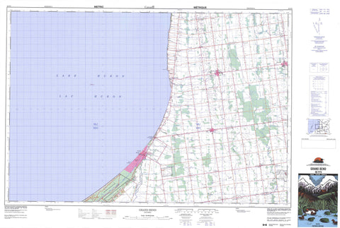
040P05 Grand Bend Canada topo map, 1:50,000 scale
040P05 Grand Bend NRCAN topographic map.
Includes UTM and GPS geographic coordinates (latitude and longitude). This 50k scale map is suitable for hiking, camping, and exploring, or you could frame it as a wall map.
Printed on-demand using high resolution, on heavy weight and acid free paper, or as an upgrade on a variety of synthetic materials.
Topos available on paper, Waterproof, Poly, or Tyvek. Usually shipping rolled, unless combined with other folded maps in one order.
- Product Number: NRCAN-040P05
- Parent Topo: TOPO-040P
- Map ID also known as: 040P05, 40P5, 40P05
- Unfolded Size: Approximately 26" high by 36" wide
- Weight (paper map): ca. 55 grams
- Map Type: POD NRCAN Topographic Map
- Map Scale: 1:50,000
- Geographical region: Ontario, Canada
Neighboring Maps:
All neighboring Canadian topo maps are available for sale online at 1:50,000 scale.
Purchase the smaller scale map covering this area: Topo-040P
Spatial coverage:
Topo map sheet 040P05 Grand Bend covers the following places:
- Dewey Point - Old Ausable Channel - Lambton Shores - Bosanquet - Hay - Huron - Lambton - McGillivray - Middlesex - Stanley - Stephen - Tuckersmith - Lac Huron - Lake Huron - Smith Lake - Huron - Lambton - Middlesex - East Williams - Grey - Hay - McGillivray - McKillop - North Middlesex - Plympton - Stanley - Stephen - Tuckersmith - Usborne - Warwick - West Williams - Williams - The Pinery Provincial Park - The Pinery Provincial Park Flood-Plain Wilderness Area - The Pinery Provincial Park Forest Wilderness Area - The Pinery Provincial Park Shore Wilderness Area - Ausable River - Bannockburn River - Black Creek - Mud Creek - Parkhill Creek - Cantin Shoal - Bluewater - Bosanquet - Huron East - South Huron - Beach O'Pines - Blake - Crediton - Dashwood - Drysdale - Goshen - Grand Bend - Harpley - Hensall - Hills Green - Khiva - Kippen - Mount Carmel - Shipka - Southcott Pines - St. Joseph - Zurich - Thedford Marsh


