
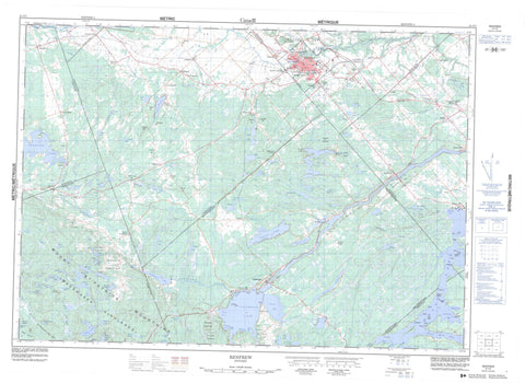
031F07 Renfrew Canada topo map, 1:50,000 scale
031F07 Renfrew NRCAN topographic map.
Includes UTM and GPS geographic coordinates (latitude and longitude). This 50k scale map is suitable for hiking, camping, and exploring, or you could frame it as a wall map.
Printed on-demand using high resolution, on heavy weight and acid free paper, or as an upgrade on a variety of synthetic materials.
Topos available on paper, Waterproof, Poly, or Tyvek. Usually shipping rolled, unless combined with other folded maps in one order.
- Product Number: NRCAN-031F07
- Parent Topo: TOPO-031F
- Map ID also known as: 031F07, 31F7, 31F07
- Unfolded Size: Approximately 26" high by 36" wide
- Weight (paper map): ca. 55 grams
- Map Type: POD NRCAN Topographic Map
- Map Scale: 1:50,000
- Geographical region: Ontario, Canada
Neighboring Maps:
All neighboring Canadian topo maps are available for sale online at 1:50,000 scale.
Purchase the smaller scale map covering this area: Topo-031F
Spatial coverage:
Topo map sheet 031F07 Renfrew covers the following places:
- Bennett Bay - Black Bay - Camerons Bay - Donnellys Bay - Eggshape Bay - Grassy Bay - Legrees Bay - Little Sand Bay - McNeelys Bay - Nettletons Bay - Pickerel Bay - Sand Bay - Sunset Bay - Three Mile Bay - Jockos Beach - Barnets Point - Bluff Point - Burnt Point - Butternut Point - Clear Point - Donnellys Point - Eagle Point - Fishers Point - Mohawk Place - Ryans Point - Squaw Point - Admaston - Bagot - Blithfield - Bromley - Brougham - Darling - Grattan - Horton - Lanark - McNab - Pakenham - Wilberforce - Andrews Island - Avalon Island - Barrys Island - Birch Island - Bogs Island - Bog's Island - Braidens Island - Corley Island - Curleys Island - Deadmans Island - Hardwood Island - Howards Island - Indian Island - Indian Islands - Indian Islands - Jacob Island - Jacob Islands - Jacob Islands - Kitty Island - McLachlins Island - Myrtle Island - Rocky Island - Ross Island - Stanley Island - Stewart Island - Waba Island - Adams Lake - Austins Lake - Balmer Lake - Bircham Lake - Black Donald Lake - Black Lake - Black Lake - Blackbird Lake - Brennan Lake - Buffalo Lake - Calabogie Lake - Carter Lake - Chamberlain Lake - Colton Lake - Condon Lake - Constan Lake - Constant Lake - Constos Lake - Cotters Lake - Culhanes Lake - Dedo Lake - Deils Lake - Dempseys Lake - Denniston Lake - Devils Hole - Dillon Lake - Discus Lake - Dominic Lake - Fergusons Lake - Fishery Lake - Franks Lake - Fraser Lake - French Lake - Garskeys Lake - Green Lake - Guiney Lake - Hartshorn Lake - Holmes Lake - Horton Lake - Hunt Lake - Hunts Lake - Hurd Lake - Hurds Lake - Jacks Lake - Jacktar Lake - Jamieson Lake - Joes Lake - Kennelly Lake - Kileys Lakes - Lafleurs Lake - Lake of the Hills - Limestone Lake - Little Black Lake - Lower Fish Lake - Lynchs Lake - MacPherson Lake - Malotte Lake - Marly Lake - Martell Lake - Mason Lake - McCool Lake - McLachlan Lake - McLellan Lake - McMaster Lake - McNab Lake - McNulty Lake - McNultys Lake - McPherson Lake - Miller Lake - Moran Lake - Moriartys Lake - Mud Lake - Mudlark Lake - Murphy Lake - Newfield Lake - Nipper Lake - Norway Lake - Parish Lake - Patrickfalls Lake - Pats Lake - Perault Lake - Pike Lake - Reid Lake - Round Lake - Ryans Lake - Samally Lake - Sammons Lake - Shannons Lakes - St. Pierre Lake - Stevens Lake - Stewarts Lake - Stones Lake - Streich Lake - Stubinskis Lake - Stufkos Lake - Taylor Lake - The Fish Lakes - The Fish Lakes - The Fish Lakes - Upper Fish Lake - Virgin Lake - Warrens Lake - Webber Lake - Whelan Lake - White Lake - Ansters Hill - Blimkies Mountain - Bonnechere Ridge - Carswells Hill - Collins Hill - Curtins Hill - Dicksons Mountain - Dillons Mountain - Ferguslea Hill - Gorras Hill - Kennellys Mountain - MacPherson Lake Mountain - Madawaska Highlands - Madawaska Hill - Maloneys Mountain - Martins Hill - McGees Hill - McGee's Mountain - McGraths Hill - Mount St. Patrick Mountains - Nolans Hill - Oak Hills - Oak Mountain - Poplar Mountain - Rock of Gibraltar - Scarfs Hill - Tatty Hill - The Pinnacle - Thompson Hill - Yellow Jacks Hill - Lanark - Renfrew - Admaston - Admaston/Bromley - Bagot and Blythfield - Bagot, Blythfield and Brougham - Bonnechere Valley - Bromley - Brougham - Darling - Grattan - Greater Madawaska - Griffith and Matawatchan - Horton - Lanark - Lanark Highlands - Lavant, Dalhousie and North Sherbrooke - McNab - McNab/Braeside - North Algona - North Algona Wilberforce - North West Lanark - Pakenham - Ramsay - Sebastopol - South Algona - Wilberforce - Centennial Lake Provincial Nature Reserve - Constant Creek Swamp and Fen Conservation Reserve - Bagot Creek - Berlanguet Creek - Berlanquet Creek - Black Donald Creek - Bonnechere River - Boundary Creek - Brandy Brook - Broad Brook - Broad Creek - Cherrys Creek - Constan Creek - Constant Creek - Crozier Creek - Culls Creek - Deils Creek - Dochart Creek - Fish Creek - Hallidays Creek - Hansons Creek - Holliday Creek - Kasaboski Creek - Kenneys Creek - Kippens Creek - Liffey Creek - Little Black Donald Creek - Little Halliday Creek - Locha Creek - Lochay Creek - Lochiel Creek - Long Lake Creek - Madawaska River - Malotte Creek - McGees Creek - Mile Creek - Moores Creek - Paris Creek - Pettigrews Creek - Raycroft Creek - Ryan Creek - Smiths Creek - Stoughtons Creek - Virgin Creek - Mississippi Mills - Renfrew - Admaston - Ashdad - Ashdod - Balaclava - Balsam Hill - Barryvale - Belangers Corner - Burnstown - Calabogie - Caldwell - Cotieville - Dacre - Douglas - Ferguslea - Fremo Corners - Glasgow Station - Gorman - Goshen - Grattan - Hurds Lake - Hyndford - Loch Winnoch - Lochwinnoch - Lower Dacre - Lundys Corners - Martin Corners - Martins Corner - Mayhew - McDougall - Moores Lake - Mount St. Patrick - Newfield - Oakgrove - Opeongo - Payne - Quilty - Renfrew Junction - Scotch Bush - Shamrock - Springtown - Spruce Hedge - Stewartville - Thompson Hill - Thomson Hill - Whelan Lake - White Lake - Blimkies Meadow


