
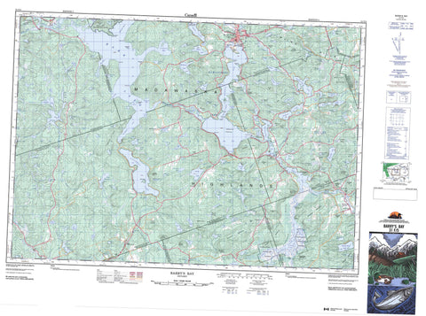
031F05 Barry s Bay Canada topo map, 1:50,000 scale
031F05 Barry s Bay NRCAN topographic map.
Includes UTM and GPS geographic coordinates (latitude and longitude). This 50k scale map is suitable for hiking, camping, and exploring, or you could frame it as a wall map.
Printed on-demand using high resolution, on heavy weight and acid free paper, or as an upgrade on a variety of synthetic materials.
Topos available on paper, Waterproof, Poly, or Tyvek. Usually shipping rolled, unless combined with other folded maps in one order.
- Product Number: NRCAN-031F05
- Parent Topo: TOPO-031F
- Map ID also known as: 031F05, 31F5, 31F05
- Unfolded Size: Approximately 26" high by 36" wide
- Weight (paper map): ca. 55 grams
- Map Type: POD NRCAN Topographic Map
- Map Scale: 1:50,000
- Geographical region: Ontario, Canada
Neighboring Maps:
All neighboring Canadian topo maps are available for sale online at 1:50,000 scale.
Purchase the smaller scale map covering this area: Topo-031F
Spatial coverage:
Topo map sheet 031F05 Barry s Bay covers the following places:
- Barrys Bay - Bedard Bay - Bell Bay - Bells Bay - Bills Bay - Blackfish Bay - Chapleau Bay - Clayfarm Bay - Cowan Bay - Halfmile Bay - Halfmoon Bay - Harris Bay - Hay Bay - Hydes Bay - Little Cub Bay - Littlebark Bay - McPhees Bay - McQuaig Bay - Mud Bay - One Mile Bay - Retza Bay - Sand Bay - Sand Bay - Thrashers Bay - Wasmund Bay - Big Point - Bleskies Point - Blueberry Point - Boffins Point - Coulas Point - Crogans Point - Depot Point - Green Point - Indian Point - Parcher Point - Squaw Point - The Narrows - The Narrows - High Falls - Neuman Falls - Bangor - Brudenell - Carlow - Hagarty - Jones - Lyell - McClure - Monteagle - Murchison - Radcliffe - Raglan - Renfrew - Sabine - Wicklow - Beavertail Island - Big Island - Chapleau Island - Davis Island - Gull Island - Mask Island - Mayflower Island - Parcher Island - Ski Island - Alexander Lake - Annies Lake - Babycoot Lake - Back Lake - Baileys Lake - Baldcoot Lake - Balsam Lake - Bancar Lake - Bark Lake - Bass Lake - Bath Lake - Bedard Ponds - Bell Rapids Lake - Bennett Lake - Biernacki Lake - Big Point Pond - Bills Pond - Birch Pond - Bird Lake - Blairs Lake - Boehmes Pond - Brisbois Pond - Brouse Pond - Buch Lake - Buck Lake - Budarick Lake - Buderick Lake - Campbell Lake - Canoe Lake - Cardwell Lake - Coffey Lake - Coghlan Lake - Combermere Lake - Crooked Lake - Cross Lake - Cybulski Lake - Daley Lake - Dam Lake - Davis Pond - Deer Lake - Diamond Lake - Divazie Lake - Dixie Lake - Drohan Lake - Dropledge Lake - Echo Lake - Evans Lake - Fish Lake - Fish Pond - Fosters Lake - Franks Lake - Frantz Pond - Franz Pond - Frogharbour Lake - Garden Lake - George Lake - Ghost Lake - Green Lake - Greenan Lake - Gruschwitz Pond - Gun Lake - Haley Lake - Halfway Lake - Harriets Lake - Hawk Lake - Helmer Lake - Hemans Lake - Hicks Lake - Hoare Lake - Hoover Lake - Hudson Pond - Indian Lake - Inright Lake - James Lake - James Pond - Johnson Lake - Kamaniskeg Lake - Kitts Lake - Kretzel Lake - Kuiack Lake - Kuick Lake - Kulas Lake - Labrador Lake - Lansing Pond - Lennon Lake - Lepenski Lake - Lepine Lake - Lève Lake - Levesque Pond - Little Gun Lake - Little Lake - Little Lyell Lake - Little Papineau Lake - Little Watson Lake - Little Wolf Lake - Little Yantha Lake - Littlecoot Lake - Lorbetski Lake - Lost Lake - Lost Pond - Luckovitch Lake - Lulum Lake - Lyell Lake - Lyell Long Lake - Maika Lake - Makeek Lake - Malone Lake - Marguardt Lake - Marquardt Lake - McCastle Pond - McCormick Lake - McKenzie Lake - McLaughlin Lake - McMaster Lake - Meadow Pond - Mekeek Lake - Menzies Pond - Middle Pond - Mill Pond - Mink Lake - Mitchell Lake - Moore Lake - Moore's Lake - Mountain Lake - Mud Pond - Mud Pond - Murack Lake - Muskrat Lake - Neds Pond - Negeek Lake - Noonan Lake - Norlock Lake - O'Grady Lake - Omega Lake - Papineau Lake - Parcher Lake - Partridge Lake - Patridge Lake - Peever Pond - Pell Lake - Peplinski Lake - Pershick Lake - Phillips Lake - Piecarski Lake - Pine Ridge Lake - Plebon Lake - Poplar Pond - Portage Pond - Potash Lake - Priests Ponds - Prince Lake - Purdy Lake - Purdy Pond - Radcliffe Lake - Raft Lake - Raglan Lake - Raglan White Lake - Recoski Lake - Recoski Pond - Ribgrass Lake - Robinson Lake - Rogge Lake - Rose Lake - Rose Pond - Sandys Lake - Serran Lake - Sherwood Lake - Shulist Lake - Smalls Lake - Snowshoe Lake - Spruce Lake - Spruce Pond - Stoney Lake - Stringer Lake - Stubbs Lake - Sucker Pond - Taylor Lake - Tea Lake - The Sea Pond - Thom Lake - Thominson Lake - Thrashers Pond - Togel Lake - Towns Pond - Trout Lake - Turf Lake - Vanderbeck Lake - Victoria Lakes - Victoria Lakes - Wadsworth Lake - Wasmund Lake - Watson Lake - Whiteduck Lake - Wicklow Lake - Winter Lake - Wolf Lake - Woodsher Lake - Yantha Lake - Yuill Lake - Zelneys Lake - Zelnys Lake - Lentz Landing - Wishman Landing - Belot Mountain - Blackcat Hill - Boehmes Mountain - Buch's Hill - Buck Lake Mountain - Budarick Hill - Bulls Run Hill - Craigmont Hill - Donnellys Hill - Gorman Mountain - Gun Mountain - Hemlock Ridge - Hochbergs Mountain - Hoover Mountain - Johnson Hill - Kellys Hill - Lavallee Hill - Madawaska Highlands - Mahon Mountain - McManus Mountain - Mick Daley Mountain - Pine Ridge - Porath Mountain - Raglan Hills - Roddens Hill - Schwieg Hill - Smeltzers Hill - Stopa Hill - Trench Hill - Weasel Lookout - William Johns Mountain - Wilno Hills - Yantha Mountain - Airy - Bangor, Wicklow and McClure - Brudenell and Lyndoch - Brudenell, Lyndoch and Raglan - Carlow - Carlow/Mayo - Hagarty and Richards - Hastings Highlands - Herschel - Killaloe, Hagarty and Richards - Madawaska Valley - Mayo - Monteagle - Radcliffe - Raglan - Sherwood, Jones and Burns - South Algonquin - Carson Lake Provincial Park - Conroys Marsh Conservation Reserve - Palmer Rapids - Alder Creek - Back Creek - Biernacki Creek - Byers Creek - Carson Creek - Coghlan Creek - Diamond Lake Creek - Goodkey Creek - Hawk Creek - Hochbergs Creek - Johnson Creek - Kitts Creek - Little Mississippi River - Little Papineau Creek - Madawaska River - McLaughlin Creek - Moore Creek - Papineau Creek - Purdy Creek - Rockingham Creek - Rose Creek - Scully Creek - Watson Creek - Whiskey Creek - York River - Yourths Creek - Barrymere - Barry's Bay - Bell Rapids - Burgess Mines - Centreview - Combermere - Craigmont - Cross Lake - Halfway - Hopefield - Jewellville - Kaszuby - Madawaska - Maple Leaf - Mayhews Landing - New Carlow - Palmer Rapids - Purdy - Siberia - Beanpot Marsh - Callaghan Marsh - Conroy Marsh - Conroys Marsh - Cranberry Marsh - Drohan Swamp - Mahon Swamp - McGillivray Marsh - Moonshine Marsh - Scully Marsh - Stewart Meadow


