
~ Lualailua Hills HI topo map, 1:24000 scale, 7.5 X 7.5 Minute, Current, 2013
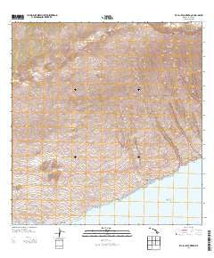
Lualailua Hills, Hawaii, USGS topographic map dated 2013.
Includes geographic coordinates (latitude and longitude). This topographic map is suitable for hiking, camping, and exploring, or framing it as a wall map.
Printed on-demand using high resolution imagery, on heavy weight and acid free paper, or alternatively on a variety of synthetic materials.
Topos available on paper, Waterproof, Poly, or Tyvek. Usually shipping rolled, unless combined with other folded maps in one order.
- Product Number: USGS-8537579
- Free digital map download (high-resolution, GeoPDF): Lualailua Hills, Hawaii (file size: 31 MB)
- Map Size: please refer to the dimensions of the GeoPDF map above
- Weight (paper map): ca. 55 grams
- Map Type: POD USGS Topographic Map
- Map Series: US Topo
- Map Verison: Current
- Cell ID: 26852
- Datum: North American Datum of 1983
- Map Projection: Transverse Mercator
- Map Cell Name: Lualailua Hills
- Grid size: 7.5 X 7.5 Minute
- Date on map: 2013
- Map Scale: 1:24000
- Geographical region: Hawaii, United States
Neighboring Maps:
All neighboring USGS topo maps are available for sale online at a variety of scales.
Spatial coverage:
Topo map Lualailua Hills, Hawaii, covers the geographical area associated the following places:
- Kāhua - Haupaʻakea Peak - Wailaulau Gulch - Polipoli Springs State Recreation Area - Kahikinui Forest Reserve - Kepuni Gulch - Manawainui - Kula Forest Reserve - Puʻukeōkea - Kīpapa - Manawainui Gulch - Ninialiʻi - Alena - Pākōwai - Lualaʻilua - Kahikinui House - Kolekole - Nāwini - Magnetic Peak - Puʻukao - Kamole Gulch - Kahale‘aimakani Gulch - Lualaʻilua Hills - Kanahau - Alena - Nakula - Kīpapa - Nakaʻaha - Kalepeamoa - Puʻupane - Auwahi - Wai‘ōpae Gulch - Manukani - Puʻualiʻi - Nakaʻaha - Poopoo Gulch - Lower Trail - Palaha Gulch - Uma - Kahawaihapapa - Nakaohu Point - Kiakeana Point - Hōkūkano - Mahamenui - Manawainui - Kahikinui Hawaiian Home Land - Nakaohu
- Map Area ID: AREA20.708333320.5833333-156.3333333-156.2083333
- Northwest corner Lat/Long code: USGSNW20.7083333-156.3333333
- Northeast corner Lat/Long code: USGSNE20.7083333-156.2083333
- Southwest corner Lat/Long code: USGSSW20.5833333-156.3333333
- Southeast corner Lat/Long code: USGSSE20.5833333-156.2083333
- Northern map edge Latitude: 20.7083333
- Southern map edge Latitude: 20.5833333
- Western map edge Longitude: -156.3333333
- Eastern map edge Longitude: -156.2083333


