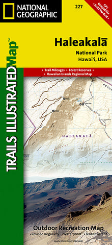
Haleakala National Park, Map 227 by National Geographic Maps
• Waterproof • Tear-Resistant • Topographic Map
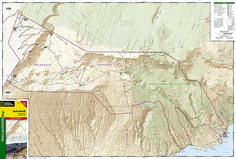
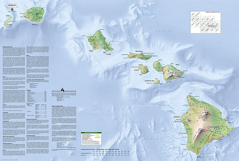
National Geographics Trails Illustrated map of Haleakala National Park is designed to meet the needs of outdoor enthusiasts by combining valuable information with extensive detail of this unique park. The map includes the entire national park area, including the summit area, the wilderness area, and the Kipahulu area. Expertly researched and created in partnership with local land management agencies, this map features key points of interest including Red Hill, Magnetic Peak, Pa Ka oao, Halalii, Ka Moa O Pele, Puu Naue, Puu Mamane, the Kahikinui Forest Reserve, Kipahulu Forest Reserve, Hana Forest Reserve, Kaapahu, and much more. Also shows Hawaii, Kahoolawe, Maui, Lanai, Molokai, Oahu, Kauai, and Niihau.
Ideal for recreation activities in this spectacular area, this map can guide you off the beaten path and back again. The clearly marked trails include mileage between intersections. The map base includes contour lines, shaded relief, and elevations for summits. Recreation features are clearly marked, including ranger stations, campgrounds, picnic areas, rental cabins, and points of interest. An informative summary of the park, average temperature and rainfall, safety tips, agency contact information, and more is provided as well.
Every Trails Illustrated map is printed on Backcountry Tough waterproof, tear-resistant paper. A full UTM grid is printed on the map to aid with GPS navigation.
- Product Number: 2032666M
- Product Code: TI_HALEAKALA
- Publisher Product ID: TI00000227
- ISBN: 9781566954044
- Year of Publication: 2000
- Folded Size: 9.45 x 4.33 inches
- Unfolded Size: 25.59 x 37.8 inches
- Map type: Folded Map
- Geographical region: Hawaii