
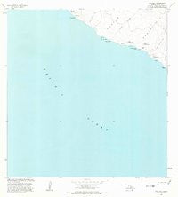
~ Puu Hou HI topo map, 1:24000 scale, 7.5 X 7.5 Minute, Historical, 1981, updated 1981
Puu Hou, Hawaii, USGS topographic map dated 1981.
Includes geographic coordinates (latitude and longitude). This topographic map is suitable for hiking, camping, and exploring, or framing it as a wall map.
Printed on-demand using high resolution imagery, on heavy weight and acid free paper, or alternatively on a variety of synthetic materials.
Topos available on paper, Waterproof, Poly, or Tyvek. Usually shipping rolled, unless combined with other folded maps in one order.
- Product Number: USGS-6063159
- Free digital map download (high-resolution, GeoPDF): Puu Hou, Hawaii (file size: 17 MB)
- Map Size: please refer to the dimensions of the GeoPDF map above
- Weight (paper map): ca. 55 grams
- Map Type: POD USGS Topographic Map
- Map Series: HTMC
- Map Verison: Historical
- Cell ID: 36698
- Scan ID: 349696
- Imprint Year: 1981
- Aerial Photo Year: 1977
- Edit Year: 1981
- Field Check Year: 1980
- Datum: Old Hawaiian
- Map Projection: Transverse Mercator
- Map published by United States Geological Survey
- Map Language: English
- Scanner Resolution: 600 dpi
- Map Cell Name: Puuhou
- Grid size: 7.5 X 7.5 Minute
- Date on map: 1981
- Map Scale: 1:24000
- Geographical region: Hawaii, United States
Neighboring Maps:
All neighboring USGS topo maps are available for sale online at a variety of scales.
Spatial coverage:
Topo map Puu Hou, Hawaii, covers the geographical area associated the following places:
- Puʻuhou - Kākio - Waialua - Kalīpoa - Hāliīpālala - Kahiola - Kahakahakea - Waiʻoʻahukini - Puʻulohena - Kepuhiokahiʻo Point - Puʻukaimuʻuala - Hāwea - Kaʻilikiʻi Beach (historical) - Kaliʻipaʻa - Puʻuwaimānalo - Kāʻilikiʻi - Puu Kahakahakea - Kalepeamoa - Kaimuʻuala - Kahiʻo
- Map Area ID: AREA1918.875-155.825-155.7
- Northwest corner Lat/Long code: USGSNW19-155.825
- Northeast corner Lat/Long code: USGSNE19-155.7
- Southwest corner Lat/Long code: USGSSW18.875-155.825
- Southeast corner Lat/Long code: USGSSE18.875-155.7
- Northern map edge Latitude: 19
- Southern map edge Latitude: 18.875
- Western map edge Longitude: -155.825
- Eastern map edge Longitude: -155.7


