
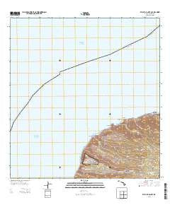
~ Makaha Point HI topo map, 1:24000 scale, 7.5 X 7.5 Minute, Historical, 2013
Makaha Point, Hawaii, USGS topographic map dated 2013.
Includes geographic coordinates (latitude and longitude). This topographic map is suitable for hiking, camping, and exploring, or framing it as a wall map.
Printed on-demand using high resolution imagery, on heavy weight and acid free paper, or alternatively on a variety of synthetic materials.
Topos available on paper, Waterproof, Poly, or Tyvek. Usually shipping rolled, unless combined with other folded maps in one order.
- Product Number: USGS-5949354
- Free digital map download (high-resolution, GeoPDF): Makaha Point, Hawaii (file size: 17 MB)
- Map Size: please refer to the dimensions of the GeoPDF map above
- Weight (paper map): ca. 55 grams
- Map Type: POD USGS Topographic Map
- Map Series: US Topo
- Map Verison: Historical
- Cell ID: 76084
- Datum: North American Datum of 1983
- Map Projection: Transverse Mercator
- Map Cell Name: Makaha Point
- Grid size: 7.5 X 7.5 Minute
- Date on map: 2013
- Map Scale: 1:24000
- Geographical region: Hawaii, United States
Neighboring Maps:
All neighboring USGS topo maps are available for sale online at a variety of scales.
Spatial coverage:
Topo map Makaha Point, Hawaii, covers the geographical area associated the following places:
- Keawanui Landing - Honopu Beach - Mākaha Ridge - Kaʻahole Valley - Mākaha Point - Po‘opo‘oiki Valley - Nuʻalolo Stream - Keawanui - ʻAwaʻawapuhi Stream - Honopu Arch - ʻAwaʻawapuhi Trail - Anaki - Nuʻalolokai State Park - Kawai‘ula Valley - Pine Forest Drive Picnic Area - Milolii - Mākole - Pa‘aiki Valley - Kuʻia Natural Area Reserve - Alapiʻi Point - Miloliʻi State Park - Nuʻalolo Trail - Paaiki Falls - Kokee Instrumentation Station - Miloliʻi Ridge - Nualolo - Honopū Valley - Mahanaloa Valley - Queens Bath - Kākiʻokeʻokeʻo Picnic Area - Makuaiki Point - Nu‘alolo Valley - Nualolo Reef - Miloli‘i Valley - Kauhao Valley - Nualolo Kai Beach - Miloliʻi Beach - Puanaiea Point - Mākaha Valley - ‘Awa‘awapuhi Valley - Ku‘ia Valley
- Map Area ID: AREA22.241666722.1166667-159.7916667-159.6666667
- Northwest corner Lat/Long code: USGSNW22.2416667-159.7916667
- Northeast corner Lat/Long code: USGSNE22.2416667-159.6666667
- Southwest corner Lat/Long code: USGSSW22.1166667-159.7916667
- Southeast corner Lat/Long code: USGSSE22.1166667-159.6666667
- Northern map edge Latitude: 22.2416667
- Southern map edge Latitude: 22.1166667
- Western map edge Longitude: -159.7916667
- Eastern map edge Longitude: -159.6666667


