
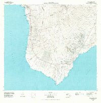
~ Hawaii County Sheet 3 HI topo map, 1:100000 scale, 30 X 60 Minute, Historical, 1980, updated 1984
Hawaii County Sheet 3, Hawaii, USGS topographic map dated 1980.
Includes geographic coordinates (latitude and longitude). This topographic map is suitable for hiking, camping, and exploring, or framing it as a wall map.
Printed on-demand using high resolution imagery, on heavy weight and acid free paper, or alternatively on a variety of synthetic materials.
Topos available on paper, Waterproof, Poly, or Tyvek. Usually shipping rolled, unless combined with other folded maps in one order.
- Product Number: USGS-5930109
- Free digital map download (high-resolution, GeoPDF): Hawaii County Sheet 3, Hawaii (file size: 26 MB)
- Map Size: please refer to the dimensions of the GeoPDF map above
- Weight (paper map): ca. 55 grams
- Map Type: POD USGS Topographic Map
- Map Series: HTMC
- Map Verison: Historical
- Cell ID: 332222
- Scan ID: 349914
- Imprint Year: 1984
- Aerial Photo Year: 1975
- Edit Year: 1980
- Datum: Old Hawaiian
- Map Projection: Universal Transverse Mercator
- Map published by United States Geological Survey
- Map Language: English
- Scanner Resolution: 600 dpi
- Map Cell Name: Hawaii 3 of 3
- Grid size: 30 X 60 Minute
- Date on map: 1980
- Map Scale: 1:100000
- Geographical region: Hawaii, United States
Neighboring Maps:
All neighboring USGS topo maps are available for sale online at a variety of scales.
Spatial coverage:
Topo map Hawaii County Sheet 3, Hawaii, covers the geographical area associated the following places:
- Keālia - Hawaiian Ocean View Estates - Waiʻōhinu - Punaluu Kahawai - Kaʻawaloa - Hoʻokena - Hīlea - Manukā (historical) - Kaunēnē - Country Garden Estates - Nīnole - Waikapuna - Keʻei - Kipuka Nahuaopala (historical) - Captain Cook - Komakawai - Hawaiian Ocean View - Nāʻālehu - Okoe (historical) - Moaula (historical) - Hoʻōpūloa - Hōnaunau - Olelomoana (historical) - Napoʻopoʻo - Honuʻapo - Kona South Estates - Punaluʻu - Napumaia (historical) - Hawaiian Ocean View Ranchos - Pāpā Bay Estates - Niuʻoʻu (historical) - Pāpā (historical) - Miloliʻi - Discovery Harbour - ʻAinapō - Keanapaʻakai (historical) - Kapuʻa (historical) - Pāhala - Kēōkea
- Map Area ID: AREA19.518.875-156.0833333-155.375
- Northwest corner Lat/Long code: USGSNW19.5-156.0833333
- Northeast corner Lat/Long code: USGSNE19.5-155.375
- Southwest corner Lat/Long code: USGSSW18.875-156.0833333
- Southeast corner Lat/Long code: USGSSE18.875-155.375
- Northern map edge Latitude: 19.5
- Southern map edge Latitude: 18.875
- Western map edge Longitude: -156.0833333
- Eastern map edge Longitude: -155.375


