
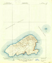
~ Kahoolawe HI topo map, 1:62500 scale, 15 X 15 Minute, Historical, 1929, updated 1947
Kahoolawe, Hawaii, USGS topographic map dated 1929.
Includes geographic coordinates (latitude and longitude). This topographic map is suitable for hiking, camping, and exploring, or framing it as a wall map.
Printed on-demand using high resolution imagery, on heavy weight and acid free paper, or alternatively on a variety of synthetic materials.
Topos available on paper, Waterproof, Poly, or Tyvek. Usually shipping rolled, unless combined with other folded maps in one order.
- Product Number: USGS-5683297
- Free digital map download (high-resolution, GeoPDF): Kahoolawe, Hawaii (file size: 5 MB)
- Map Size: please refer to the dimensions of the GeoPDF map above
- Weight (paper map): ca. 55 grams
- Map Type: POD USGS Topographic Map
- Map Series: HTMC
- Map Verison: Historical
- Cell ID: 55953
- Scan ID: 349853
- Imprint Year: 1947
- Survey Year: 1926
- Datum: Old Hawaiian
- Map Projection: Polyconic
- Map published by United States Geological Survey
- Keywords: Overedge
- Map Language: English
- Scanner Resolution: 600 dpi
- Map Cell Name: Kahoolawe
- Grid size: 15 X 15 Minute
- Date on map: 1929
- Map Scale: 1:62500
- Geographical region: Hawaii, United States
Neighboring Maps:
All neighboring USGS topo maps are available for sale online at a variety of scales.
Spatial coverage:
Topo map Kahoolawe, Hawaii, covers the geographical area associated the following places:
- Lae ʻO Honokoʻa - Lua ʻO Keaualuna - Lae ʻO Kūakaʻiwa - Wa‘aiki Gulch - Makaʻalae - Honukanaenae - Keoneuli - Papaka Iki - Ahupū Bay - Papaka Nui Gulch - Kaluao Kamohoaliʻi - Keanakeiki - Kaulana Gulch - Puʻulaʻi - Kaukaukapapa Beach - Honokanaiʻa - Lae ʻO Kaule - Luamakika - Pali ʻO Kalapakea - Waʻaiki - Wiliwilipeʻapeʻa - Puʻu ʻO Moaʻula Iki - Honukanaenae - Waihonu Gulch - Kanuku - Kaukamoku - Lae ʻO Hilukea - Honokoʻa Bay - Southwest Point Light - Big Gulch - Lua ʻO Keaualalo - Waikahalulu Gulch - Honokanaiʻa - Waikahalulu Bay - Hulākao - Laepakī - Puʻukoaʻe - Kuheeia (historical) - Puʻukahua - Lae ʻO Kealaikahiki - Ilʻiliʻililoa - Kaukamoku Gulch - Lae ʻO Kuikui - Kahoʻolawe - Hale ʻO Papa Heiau - Puhi ʻO Kōheohala - Kiʻi - Lae ʻO Hiluʻula - Kamōhio - Ahupūiki Gulch - Hanakanaeʻa Beach - Lae ʻO Kākā - Puʻu ʻO Moaʻula Nui - Kalama - Puhianenue - Papaka Nui - Lae ʻO Hālona - Puʻumōiwi - ʻAleʻale - Lua ʻO Keālialalo - Kamōhio Bay - Kuheeia Bay - Lua ʻO Keālialuna - Kānaloa Gulch - Papaka Iki Gulch - ʻOawawahie - Kealaikahiki Channel - The Arch - Kanapou Bay - Kaulana - Kaukamaka Gulch - Lae ʻO Nākoholā - Ahupū Iki Bay - Hakioawa - Kaulana Beach - Ahupū Gulch - Olohia Gulch
- Map Area ID: AREA20.7520.5-156.7083333-156.5
- Northwest corner Lat/Long code: USGSNW20.75-156.7083333
- Northeast corner Lat/Long code: USGSNE20.75-156.5
- Southwest corner Lat/Long code: USGSSW20.5-156.7083333
- Southeast corner Lat/Long code: USGSSE20.5-156.5
- Northern map edge Latitude: 20.75
- Southern map edge Latitude: 20.5
- Western map edge Longitude: -156.7083333
- Eastern map edge Longitude: -156.5


