
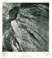
~ Mauna Loa HI topo map, 1:24000 scale, 7.5 X 7.5 Minute, Historical, 1978, updated 1981
Mauna Loa, Hawaii, USGS topographic map dated 1978.
Includes geographic coordinates (latitude and longitude). This topographic map is suitable for hiking, camping, and exploring, or framing it as a wall map.
Printed on-demand using high resolution imagery, on heavy weight and acid free paper, or alternatively on a variety of synthetic materials.
Topos available on paper, Waterproof, Poly, or Tyvek. Usually shipping rolled, unless combined with other folded maps in one order.
- Product Number: USGS-5644210
- Free digital map download (high-resolution, GeoPDF): Mauna Loa, Hawaii (file size: 24 MB)
- Map Size: please refer to the dimensions of the GeoPDF map above
- Weight (paper map): ca. 55 grams
- Map Type: POD USGS Topographic Map
- Map Series: HTMC
- Map Verison: Historical
- Cell ID: 28055
- Scan ID: 349579
- Imprint Year: 1981
- Aerial Photo Year: 1978
- Datum: Old Hawaiian
- Map Projection: Transverse Mercator
- Orthophoto: Quad
- Map published by United States Geological Survey
- Keywords: Nonstandard Press Run
- Map Language: English
- Scanner Resolution: 600 dpi
- Map Cell Name: Mauna Loa
- Grid size: 7.5 X 7.5 Minute
- Date on map: 1978
- Map Scale: 1:24000
- Geographical region: Hawaii, United States
Neighboring Maps:
All neighboring USGS topo maps are available for sale online at a variety of scales.
Spatial coverage:
Topo map Mauna Loa, Hawaii, covers the geographical area associated the following places:
- Mauna Loa Summit Cairn - 1949 Cone - Hawaiʻi Volcanoes National Park - South Pit - Kapāpala Forest Reserve - Anipeʻahi - North Pit - Puʻu Eleʻele - Wilkes Camp - Lava Flow of 1926 - Na Puu Waenakonu (historical) - Lua Hohonu - 1940 Cone - Mauna Loa Cabin - Mokuʻāweoweo Caldera - Lua Hou - Summit Patrol Cabin - Lava Flow of 1949 - Hāmākua District - Lua Poholo - Jaggars Cave - Pōhaku Hanalei - ʻAinapō Trail - Mauna Loa
- Map Area ID: AREA19.519.375-155.625-155.5
- Northwest corner Lat/Long code: USGSNW19.5-155.625
- Northeast corner Lat/Long code: USGSNE19.5-155.5
- Southwest corner Lat/Long code: USGSSW19.375-155.625
- Southeast corner Lat/Long code: USGSSE19.375-155.5
- Northern map edge Latitude: 19.5
- Southern map edge Latitude: 19.375
- Western map edge Longitude: -155.625
- Eastern map edge Longitude: -155.5


