
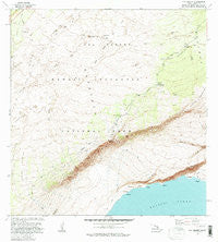
~ Kau Desert HI topo map, 1:24000 scale, 7.5 X 7.5 Minute, Historical, 1981, updated 1983
Kau Desert, Hawaii, USGS topographic map dated 1981.
Includes geographic coordinates (latitude and longitude). This topographic map is suitable for hiking, camping, and exploring, or framing it as a wall map.
Printed on-demand using high resolution imagery, on heavy weight and acid free paper, or alternatively on a variety of synthetic materials.
Topos available on paper, Waterproof, Poly, or Tyvek. Usually shipping rolled, unless combined with other folded maps in one order.
- Product Number: USGS-5643854
- Free digital map download (high-resolution, GeoPDF): Kau Desert, Hawaii (file size: 11 MB)
- Map Size: please refer to the dimensions of the GeoPDF map above
- Weight (paper map): ca. 55 grams
- Map Type: POD USGS Topographic Map
- Map Series: HTMC
- Map Verison: Historical
- Cell ID: 23082
- Scan ID: 349392
- Imprint Year: 1983
- Woodland Tint: Yes
- Visual Version Number: 1
- Aerial Photo Year: 1977
- Edit Year: 1981
- Field Check Year: 1980
- Datum: Old Hawaiian
- Map Projection: Transverse Mercator
- Map published by United States Geological Survey
- Map Language: English
- Scanner Resolution: 600 dpi
- Map Cell Name: Kau Desert
- Grid size: 7.5 X 7.5 Minute
- Date on map: 1981
- Map Scale: 1:24000
- Geographical region: Hawaii, United States
Neighboring Maps:
All neighboring USGS topo maps are available for sale online at a variety of scales.
Spatial coverage:
Topo map Kau Desert, Hawaii, covers the geographical area associated the following places:
- Hilina Pali Trail - Kīpukaʻāhiu - Lava Flow of 1920 - Kamakaiʻa Hills - Kakiiwai - Kīpukanēnē - Pohakaa Arroyo - Pali Lele o Kalihipaʻa - Halapē Trail - Kamakaiawaena - Hawai'i Volcanoes Wilderness - Puʻukapukapu - Pepeiao Cabin - Kāluʻe - Kahele - Halapē Shelter - Halapē - Cone Crater - Twin Pit Craters - Ahiu - Kaʻaha - Nanahu - Kaʻaha Trail - Keanabihopa - Moolelo Pali - Kīpukakeanabihopa - Makahanu Pali - Kīpuka Pepeiao - Kamakaiʻa Lava Flow - Kīpukapapālinamoku - Kaʻū Desert Trailhead - Kaʻaha Shelter - Kaʻū Desert - Maunaiki - Puʻukaone - Kamakaiauka - Moo Arroyo - Footprints - Puʻukoaʻe - Maunaiki Trail - Puu Ohale - Hilina Pali - Kaʻū Desert Trail - Keaoi Island
- Map Area ID: AREA19.37519.25-155.375-155.25
- Northwest corner Lat/Long code: USGSNW19.375-155.375
- Northeast corner Lat/Long code: USGSNE19.375-155.25
- Southwest corner Lat/Long code: USGSSW19.25-155.375
- Southeast corner Lat/Long code: USGSSE19.25-155.25
- Northern map edge Latitude: 19.375
- Southern map edge Latitude: 19.25
- Western map edge Longitude: -155.375
- Eastern map edge Longitude: -155.25


