
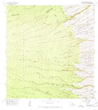
~ Akaka Falls HI topo map, 1:24000 scale, 7.5 X 7.5 Minute, Historical, 1966, updated 1967
Akaka Falls, Hawaii, USGS topographic map dated 1966.
Includes geographic coordinates (latitude and longitude). This topographic map is suitable for hiking, camping, and exploring, or framing it as a wall map.
Printed on-demand using high resolution imagery, on heavy weight and acid free paper, or alternatively on a variety of synthetic materials.
Topos available on paper, Waterproof, Poly, or Tyvek. Usually shipping rolled, unless combined with other folded maps in one order.
- Product Number: USGS-5643508
- Free digital map download (high-resolution, GeoPDF): Akaka Falls, Hawaii (file size: 10 MB)
- Map Size: please refer to the dimensions of the GeoPDF map above
- Weight (paper map): ca. 55 grams
- Map Type: POD USGS Topographic Map
- Map Series: HTMC
- Map Verison: Historical
- Cell ID: 319
- Scan ID: 349204
- Imprint Year: 1967
- Woodland Tint: Yes
- Aerial Photo Year: 1965
- Field Check Year: 1966
- Datum: Old Hawaiian
- Map Projection: Polyconic
- Map published by United States Geological Survey
- Map Language: English
- Scanner Resolution: 600 dpi
- Map Cell Name: Akaka Falls
- Grid size: 7.5 X 7.5 Minute
- Date on map: 1966
- Map Scale: 1:24000
- Geographical region: Hawaii, United States
Neighboring Maps:
All neighboring USGS topo maps are available for sale online at a variety of scales.
Spatial coverage:
Topo map Akaka Falls, Hawaii, covers the geographical area associated the following places:
- Honomū Homesteads - Waikoʻana Stream - Pāhoehoe - Pāpaʻikou - Onomea - ʻAkaka Falls State Park - Kaiwiki - Honohina Gulch - Paukaʻa - Hakalau Nui - Kahūnā Falls - Wahiloa Falls - Honomū - Kalākāoʻo Stream - Hakalau - Waiemi Falls - Wailepua Spring - Kūhua - Kawainui - Alakahi - ʻAlae - Kīkala - Pōhakupaʻa Stream - Makahanaloa - ʻAkaka Falls - Mauna Kea-Honolii Airport (historical) - Kaʻuku - Kahina Pokii Stream (historical) - Kaupākuea Homesteads - Honomū Hawaiian Home Land - Kīkala Stream - Maukaloa Camp - Puumoi - Laʻimi - Kaʻieʻie Homesteads - Papaikou-Wailea Division - Kaiwiki Homesteads One-Two - KFSH-FM (Hilo)
- Map Area ID: AREA19.87519.75-155.25-155.125
- Northwest corner Lat/Long code: USGSNW19.875-155.25
- Northeast corner Lat/Long code: USGSNE19.875-155.125
- Southwest corner Lat/Long code: USGSSW19.75-155.25
- Southeast corner Lat/Long code: USGSSE19.75-155.125
- Northern map edge Latitude: 19.875
- Southern map edge Latitude: 19.75
- Western map edge Longitude: -155.25
- Eastern map edge Longitude: -155.125


