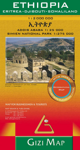
Ethiopia : Eritrea, Djibouti, Somaliland : 1:2,000,000 : Addis Ababa 1:25,000 : Simien national park 1:275,000 : geographical map
Ethiopia at 1:2,000,000 from Gizi Map with a street plan of central Adis Abeba, plus enlargements of the capital’s environs and the Simen National Park. Excellent presentation of the terrain in the publisher’s characteristic bold altitude colouring with plenty of spot heights and names of peaks, mountain ranges, etc, plus additional graphics for flood plains, swamps, salt flats, deserts, lava fields, wadis and water wells provide a vivid picture of Ethiopia’s geography. National parks or other protected areas and interesting natural sites are highlighted.
Coverage includes Eritrea and Djibouti, extending over the Red Sea to Sana’a and Aden. In the north-west the map extends to Khartoum to cover the whole course of the Blue Nile. Also included is a large part of Somalia, with its regions annotated according to their current (2011) political situation. Where appropriate, disputed boundaries (e.g. the Ilemi Triangle) are indicated. Place names of towns and of the country’s adminis
- Product Number: GIZ_ETH_19
- Reference Product Number: - None -
- ISBN: 9786155010026
- Date of Publication: 6/1/2019
- Folded Size: 9.45 inches high by 5.12 inches wide
- Unfolded (flat) Size: 38.19 inches high by 34.65 inches wide
- Map format: Folded
- Map type: Trade Maps - Physical
- Geographical region: Djibouti,Eritrea,Ethiopia,Somalia