
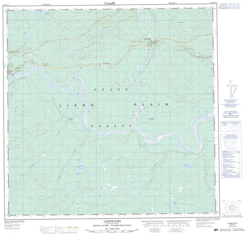
104P16 Lower Post Canada topo map, 1:50,000 scale
104P16 Lower Post NRCAN topographic map.
Includes UTM and GPS geographic coordinates (latitude and longitude). This 50k scale map is suitable for hiking, camping, and exploring, or you could frame it as a wall map.
Printed on-demand using high resolution, on heavy weight and acid free paper, or as an upgrade on a variety of synthetic materials.
Topos available on paper, Waterproof, Poly, or Tyvek. Usually shipping rolled, unless combined with other folded maps in one order.
- Product Number: NRCAN-104P16
- Parent Topo: TOPO-104P
- Map ID also known as: 104P16
- Unfolded Size: Approximately 26" high by 36" wide
- Weight (paper map): ca. 55 grams
- Map Type: POD NRCAN Topographic Map
- Map Scale: 1:50,000
- Geographical region: British Columbia, Canada
Neighboring Maps:
All neighboring Canadian topo maps are available for sale online at 1:50,000 scale.
Purchase the smaller scale map covering this area: Topo-104P
Spatial coverage:
Topo map sheet 104P16 Lower Post covers the following places:
- Cassiar Land District - Liard River Indian Reserve 3 - Réserve indienne Liard River 3 - Mayfield Lake - McNab Lake - McTavish Lake - Moffatt Lake - Moose Pond - Nancy Lake - Moffatt Hill - Hyland River Park - Liard Plain - Black Angus Creek - Dease River - Hyland River - Kaska Creek - Kloye Creek - Liard River - Liard Tom Creek - Malcolm Creek - Mayfield Creek - Tatisno Creek - Trepanier Creek - Lower Post


