
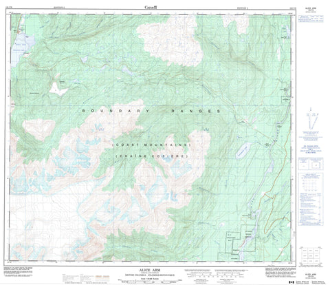
103P06 Alice Arm Canada topo map, 1:50,000 scale
103P06 Alice Arm NRCAN topographic map.
Includes UTM and GPS geographic coordinates (latitude and longitude). This 50k scale map is suitable for hiking, camping, and exploring, or you could frame it as a wall map.
Printed on-demand using high resolution, on heavy weight and acid free paper, or as an upgrade on a variety of synthetic materials.
Topos available on paper, Waterproof, Poly, or Tyvek. Usually shipping rolled, unless combined with other folded maps in one order.
- Product Number: NRCAN-103P06
- Parent Topo: TOPO-103P
- Map ID also known as: 103P06, 103P6
- Unfolded Size: Approximately 26" high by 36" wide
- Weight (paper map): ca. 55 grams
- Map Type: POD NRCAN Topographic Map
- Map Scale: 1:50,000
- Geographical region: British Columbia, Canada
Neighboring Maps:
All neighboring Canadian topo maps are available for sale online at 1:50,000 scale.
Purchase the smaller scale map covering this area: Topo-103P
Spatial coverage:
Topo map sheet 103P06 Alice Arm covers the following places:
- Alice Arm - Illiance Point - Aiyansh Indian Reserve 1 - Anokswok Indian Reserve 59 - Gitquinmiyaue Indian Reserve 76 - Gitzault Indian Reserve 24 - Gwindebilk Indian Reserve 51 - Kitladamax Indian Reserve 1A - Kwinamuck IndianReserve 49 - Réserve indienne Aiyansh 1 - Réserve indienne Anokswok 59 - Réserve indienne Gitquinmiyaue 76 - Réserve indienne Gitzault 24 - Réserve indienne Gwindebilk 51 - Réserve indienne Kitladamax 1A - Réserve indienne Kwinamuck 49 - Réserve indienne Taylor Lake 50 - Réserve indienne Tsimmanweenclist 2 - Taylor Lake Indian Reserve 50 - Tsimmanweenclist Indian Reserve 2 - Kwinamuck Lake - Patsy Lake - Rob Lake - Taylor Lake - Boundary Ranges - Chaîne Côtière - Coast Mountains - Dawson Range - Dawson Ridge - Mohawk Mountain - Widdzech Mountain - Regional District of Kitimat-Stikine - Strombeck Park - Chemainuk Creek - Chigatlque Creek - Clary Creek - Dak River - Falls Creek - Foxy Creek - Hoan Creek - Illiance River - Khimatlque Creek - Kitsault River - Kshadin Creek - Ksi Gwinhat'al - Ksi Sgasginist - Kwinamuck Creek - Kwinatahl River - Lime Creek - Maughlin Creek - Morley Creek - North Seaskinnish Creek - Patsy Creek - Roundy Creek - Seaskinnish Creek - Shumal Creek - Theophilus Creek - Wilauks Creek - Ts'im Anwiihlist - Gits'oohl - Aiyansh - Alice Arm - Gitlaxksiip - Kitsault - Silver City


