
103O01E Ashington Range Canada topo map, 1:50,000 scale
103O01E Ashington Range NRCAN topographic map.
Includes UTM and GPS geographic coordinates (latitude and longitude). This 50k scale map is suitable for hiking, camping, and exploring, or you could frame it as a wall map.
Printed on-demand using high resolution, on heavy weight and acid free paper, or as an upgrade on a variety of synthetic materials.
Topos available on paper, Waterproof, Poly, or Tyvek. Usually shipping rolled, unless combined with other folded maps in one order.
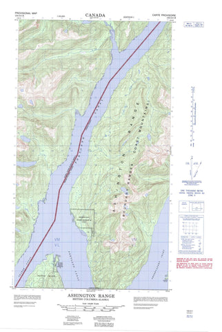
- Halfsheet: This map was designed as a half sheet of NRCAN-103O01, and it is the Eastern half. Find the western half sheet here.
- Product Number: NRCAN-103O01E
- Parent Topo: TOPO-103O
- Map ID also known as: 103O01, 103O1
- Unfolded Size: Approximately 26" high by 36" wide
- Weight (paper map): ca. 55 grams
- Map Type: POD NRCAN Topographic Map
- Map Scale: 1:50,000
- Geographical region: British Columbia, Canada
Neighboring Maps:
All neighboring Canadian topo maps are available for sale online at 1:50,000 scale.
Purchase the smaller scale map covering this area: Topo-103O
Spatial coverage:
Topo map sheet 103O01E Ashington Range covers the following places:
- Dogfish Bay - Dogfish Bight - Observatory Inlet - Whiskey Bay - Whisky Bay - Dent Bluff - Dickens Point - Logan Point - Nass Point - Spit Point - Stopford Point - Tree Point - Pearse Canal - Portland Canal - Dogfish Bay Indian Reserve 42 - Kincolith Indian Reserve 14A - Pearse Island Indian Reserve 43 - Réserve indienne Dogfish Bay 42 - Réserve indienne Kincolith 14A - Réserve indienne Pearse Island 43 - Pearse Island - Windy Island - Ashington Range - Boundary Ranges - Chaîne Côtière - Coast Mountains - Mount Jauncey - White Bluff - Regional District of Kitimat-Stikine - Wil Milit - Xmaat'in


