
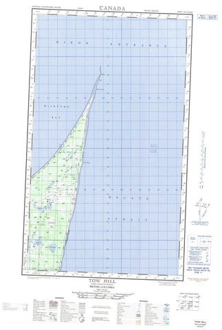
103J04E Tow Hill Canada topo map, 1:50,000 scale
103J04E Tow Hill NRCAN topographic map.
Includes UTM and GPS geographic coordinates (latitude and longitude). This 50k scale map is suitable for hiking, camping, and exploring, or you could frame it as a wall map.
Printed on-demand using high resolution, on heavy weight and acid free paper, or as an upgrade on a variety of synthetic materials.
Topos available on paper, Waterproof, Poly, or Tyvek. Usually shipping rolled, unless combined with other folded maps in one order.
- Halfsheet: This map was designed as a half sheet of NRCAN-103J04, and it is the Eastern half. Find the western half sheet here.
- Product Number: NRCAN-103J04E
- Parent Topo: TOPO-103J
- Map ID also known as: 103J04, 103J4
- Unfolded Size: Approximately 26" high by 36" wide
- Weight (paper map): ca. 55 grams
- Map Type: POD NRCAN Topographic Map
- Map Scale: 1:50,000
- Geographical region: British Columbia, Canada
Neighboring Maps:
All neighboring Canadian topo maps are available for sale online at 1:50,000 scale.
Purchase the smaller scale map covering this area: Topo-103J
Spatial coverage:
Topo map sheet 103J04E Tow Hill covers the following places:
- McIntyre Bay - North Beach - Fife Point - Rose Point - Rose Spit - Yakan Point - Dixon Entrance - Hecate Strait - Hiellen Indian Reserve 2 - Réserve indienne Hiellen 2 - Réserve indienne Yagan 3 - Yagan Indian Reserve 3 - Graham Island - Queen Charlotte Islands - Anser Lake - Clearwater Lake - Cygnet Lake - Grus Lake - Grus Lakes - Harelda Lakes - Herald Lake - Imber Lake - Kumara Lake - Lumme Lake - Mica Lake - Purdy Lake - Silver Lake - Argonaut Hill - Swan Hill - Tow Hill - Naikoon Park - Tow Hill Park - Chown Brook - Hiellen River - Kliki Damen - Kliki Damen Creek - Sangan River - Skonun River - Swan Creek - Tow Hill


