
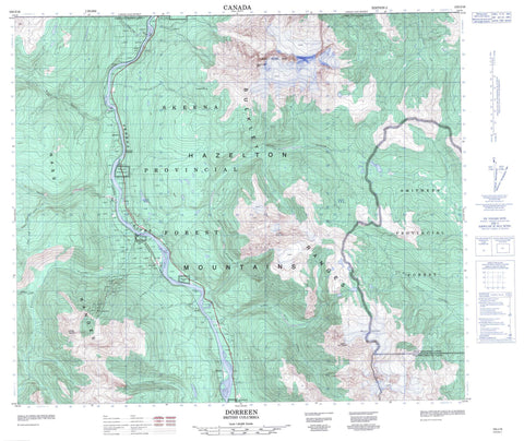
103I16 Dorreen Canada topo map, 1:50,000 scale
103I16 Dorreen NRCAN topographic map.
Includes UTM and GPS geographic coordinates (latitude and longitude). This 50k scale map is suitable for hiking, camping, and exploring, or you could frame it as a wall map.
Printed on-demand using high resolution, on heavy weight and acid free paper, or as an upgrade on a variety of synthetic materials.
Topos available on paper, Waterproof, Poly, or Tyvek. Usually shipping rolled, unless combined with other folded maps in one order.
- Product Number: NRCAN-103I16
- Parent Topo: TOPO-103I
- Map ID also known as: 103I16
- Unfolded Size: Approximately 26" high by 36" wide
- Weight (paper map): ca. 55 grams
- Map Type: POD NRCAN Topographic Map
- Map Scale: 1:50,000
- Geographical region: British Columbia, Canada
Neighboring Maps:
All neighboring Canadian topo maps are available for sale online at 1:50,000 scale.
Purchase the smaller scale map covering this area: Topo-103I
Spatial coverage:
Topo map sheet 103I16 Dorreen covers the following places:
- Borden Glacier - Chig-in-kaht Indian Reserve 8 - Ikshenigwolk Indian Reserve 3 - Ketoneda Indian Reserve 7 - Kwa-tsa-lix Indian Reserve 4 - Réserve indienne Chig-in-kaht 8 - Réserve indienne Ikshenigwolk 3 - Réserve indienne Ketoneda 7 - Réserve indienne Kwa-tsa-lix 4 - Artemis Peak - Bulkley Ranges - Coast Mountains - Hazelton Mountains - Kitshin Peak - Kletoosho Peak - Knauss Mountain - Mount Knauss - Mount Quinlan - Mount Sir Robert - Nass Range - Nass Ranges - Orion Peak - Seven Sisters Mountain - Seven Sisters Peaks - Tagai Peak - Tingi Peak - Tlooki Peak - Tuatoosho Peak - Weeskinisht Peak - Regional District of Kitimat-Stikine - Seven Sisters Park - Oliver Riffle - Carpenter Creek - Fiddler Creek - Flint Creek - Gosling Creek - Hammersley Creek - Hampson Creek - Insect Creek - Knauss Creek - Little Oliver Creek - Lorne Creek - Mosquito Creek - Mulwain Creek - Nobby Creek - Oliver Creek - Porcupine Creek - Quill Creek - Red Canyon Creek - Sand Creek - Sanson Creek - Skeena River - South Lorne Creek - Taylor Creek - Devils Elbow - Dorreen - Grand Trunk - Pacific - Ritchie - Klootch Canyon - Klootchman Canyon


