
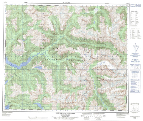
103I12 Khutzeymateen River Canada topo map, 1:50,000 scale
103I12 Khutzeymateen River NRCAN topographic map.
Includes UTM and GPS geographic coordinates (latitude and longitude). This 50k scale map is suitable for hiking, camping, and exploring, or you could frame it as a wall map.
Printed on-demand using high resolution, on heavy weight and acid free paper, or as an upgrade on a variety of synthetic materials.
Topos available on paper, Waterproof, Poly, or Tyvek. Usually shipping rolled, unless combined with other folded maps in one order.
- Product Number: NRCAN-103I12
- Parent Topo: TOPO-103I
- Map ID also known as: 103I12
- Unfolded Size: Approximately 26" high by 36" wide
- Weight (paper map): ca. 55 grams
- Map Type: POD NRCAN Topographic Map
- Map Scale: 1:50,000
- Geographical region: British Columbia, Canada
Neighboring Maps:
All neighboring Canadian topo maps are available for sale online at 1:50,000 scale.
Purchase the smaller scale map covering this area: Topo-103I
Spatial coverage:
Topo map sheet 103I12 Khutzeymateen River covers the following places:
- Khutzeymateen Inlet - Quottoon Inlet - North Arm of Work Channel - Cordierite Crag - Carm Creek Indian Reserve 38 - Kateen River Indian Reserve 39 - Khutzemateen Indian Reserve 49 - Meyanlow Indian Reserve 58 - Réserve indienne Carm Creek 38 - Réserve indienne Kateen River 39 - Réserve indienne Khutzemateen 49 - Réserve indienne Meyanlow 58 - Réserve indienne Toon 15 - Toon Indian Reserve 15 - Ryan Lake - Toon Lake - Carm Peak - Chaîne Côtière - Coast Mountains - Kitimat Ranges - Lluvia Peak - Mount Campagnolo - Mount Hodgkinson - Mount Ponder - Mount Suden - Niebla Mountain - Redcap Mountain - Tide Mountain - Regional District of Kitimat-Stikine - Khutzeymateen Grizzly Sanctuary - Khutzeymateen Park - K'tzim-a-deen Grizzly Sanctuary - Amoth Creek - Carm Creek - Cedar Creek - Exchamsiks River - Ishkheenickh River - Kateen River - Khutzeymateen River - Khyex River - Kwinamass River - Larch Creek - Mouse Creek - Stalker Creek - Toon River


