
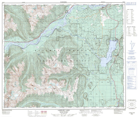
103I07 Lakelse Lake Canada topo map, 1:50,000 scale
103I07 Lakelse Lake NRCAN topographic map.
Includes UTM and GPS geographic coordinates (latitude and longitude). This 50k scale map is suitable for hiking, camping, and exploring, or you could frame it as a wall map.
Printed on-demand using high resolution, on heavy weight and acid free paper, or as an upgrade on a variety of synthetic materials.
Topos available on paper, Waterproof, Poly, or Tyvek. Usually shipping rolled, unless combined with other folded maps in one order.
- Product Number: NRCAN-103I07
- Parent Topo: TOPO-103I
- Map ID also known as: 103I07, 103I7
- Unfolded Size: Approximately 26" high by 36" wide
- Weight (paper map): ca. 55 grams
- Map Type: POD NRCAN Topographic Map
- Map Scale: 1:50,000
- Geographical region: British Columbia, Canada
Neighboring Maps:
All neighboring Canadian topo maps are available for sale online at 1:50,000 scale.
Purchase the smaller scale map covering this area: Topo-103I
Spatial coverage:
Topo map sheet 103I07 Lakelse Lake covers the following places:
- Furlong Bay - Muller Bay - Cainey Point - Catt Point - Gainey Point - Graveyard Point - Mailbox Point - Squirrel Point - Terrace - Klakelse Indian Reserve 86 - Ksames Indian Reserve 85 - Kulspai Indian Reserve 6 - Lakelse Indian Reserve 25 - Lakgeas Indian Reserve 87 - Réserve indienne Klakelse 86 - Réserve indienne Ksames 85 - Réserve indienne Kulspai 6 - Réserve indienne Lakelse 25 - Réserve indienne Lakgeas 87 - Réserve indienne Zimagord 3 - Zimagord Indian Reserve 3 - Brauns Island - Ferry Island - Little Island - Clearwater Lakes - Ena Lake - End Lake - Hai Lake - Hellsgate Slough - Herman Lake - Lakelse Lake - Onion Lake - West Lake - Chaîne Côtière - Coast Mountains - Forceman Ridge - Kitimat Ranges - Larsen Ridge - Mount Catt - Mount Cecil - Mount Gordon - Mount Herman - Mount Hipp - Mount Johnstone - Mount Little - Mount Remo - Nash Ridge - Nass Ridge - Tri Mountain - Wedeene Mountain - Wye Mountain - Regional District of Kitimat-Stikine - Lakelse Lake Park - Terrace Park - Shames Mountain - Alwyn Creek - Amsbury Creek - Andalas Creek - Aveling Creek - Cecil Creek - Chist Creek - Chris Creek - Clearwater Creek - Coldwater Creek - Dasque Creek - Delta Creek - Ena Creek - Furlong Creek - Galloway Creek - Hatchery Creek - Herman Creek - Kitimat River - Lakelse River - Lone Wolf Creek - Schulbuckhand Creek - Shames River - Skeena River - Sockeye Creek - Sparkes Creek - Thornhill Creek - Wedeene River - White Creek - Whitebottom Creek - Williams Creek - Zymagotitz River - Lakelse Hot Springs - Amsbury - DuBose - Halliday - Lakelse - Lakelse - Lakelse Lake - Old Remo - Remo - Shames - Thunderbird


