
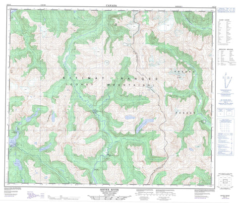
103I05 Khyex Canada topo map, 1:50,000 scale
103I05 Khyex NRCAN topographic map.
Includes UTM and GPS geographic coordinates (latitude and longitude). This 50k scale map is suitable for hiking, camping, and exploring, or you could frame it as a wall map.
Printed on-demand using high resolution, on heavy weight and acid free paper, or as an upgrade on a variety of synthetic materials.
Topos available on paper, Waterproof, Poly, or Tyvek. Usually shipping rolled, unless combined with other folded maps in one order.
- Product Number: NRCAN-103I05
- Parent Topo: TOPO-103I
- Map ID also known as: 103I05, 103I5
- Unfolded Size: Approximately 26" high by 36" wide
- Weight (paper map): ca. 55 grams
- Map Type: POD NRCAN Topographic Map
- Map Scale: 1:50,000
- Geographical region: British Columbia, Canada
Neighboring Maps:
All neighboring Canadian topo maps are available for sale online at 1:50,000 scale.
Purchase the smaller scale map covering this area: Topo-103I
Spatial coverage:
Topo map sheet 103I05 Khyex covers the following places:
- Davies Bay - Quottoon Inlet - Jane Point - Davies Narrows - North Arm of Work Channel - Wark Channel - Work Channel - Kasiks River Indian Reserve 29 - Ksagwisgwas Indian Reserve 62 - Ksagwisgwas Indian Reserve 63 - Kyex Indian Reserve 64 - Lachmach Indian Reserve 16 - Maganktoon Indian Reserve 56 - Réserve indienne Kasiks River 29 - Réserve indienne Ksagwisgwas 62 - Réserve indienne Ksagwisgwas 63 - Réserve indienne Kyex 64 - Réserve indienne Lachmach 16 - Réserve indienne Maganktoon 56 - Réserve indienne Wudzimagon 61 - Wudzimagon Indian Reserve 61 - Arden Lake - Davies Lagoon - Lachmach Lake - Leverson Lake - Minerva Lake - Splitmountain Lake - Toon Lake - Chaîne Côtière - Coast Mountains - Cumulate Peak - Kasiks Mountain - Khyex Tower - Kitimat Ranges - Split Mountain - Thulme Peak - Antigonish Creek - Arden Creek - Exchamsiks River - Fortune Creek - Inver Creek - Kasiks River - Khyex River - Kwinitsa Creek - Kwinitsa River - Lachmach River - Leverson Creek - McNeil River - Thulme River - Toon River


