
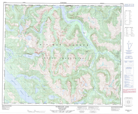
103H13 Kumealon Lake Canada topo map, 1:50,000 scale
103H13 Kumealon Lake NRCAN topographic map.
Includes UTM and GPS geographic coordinates (latitude and longitude). This 50k scale map is suitable for hiking, camping, and exploring, or you could frame it as a wall map.
Printed on-demand using high resolution, on heavy weight and acid free paper, or as an upgrade on a variety of synthetic materials.
Topos available on paper, Waterproof, Poly, or Tyvek. Usually shipping rolled, unless combined with other folded maps in one order.
- Product Number: NRCAN-103H13
- Parent Topo: TOPO-103H
- Map ID also known as: 103H13
- Unfolded Size: Approximately 26" high by 36" wide
- Weight (paper map): ca. 55 grams
- Map Type: POD NRCAN Topographic Map
- Map Scale: 1:50,000
- Geographical region: British Columbia, Canada
Neighboring Maps:
All neighboring Canadian topo maps are available for sale online at 1:50,000 scale.
Purchase the smaller scale map covering this area: Topo-103H
Spatial coverage:
Topo map sheet 103H13 Kumealon Lake covers the following places:
- Baker Inlet - Kumealon Inlet - Kxngeal Inlet - Griffon Point - Northness Point - Grenville Channel - Kumealon Narrows - Watts Narrows - Iakvas Indian Reserve 68 - Knokmolks Indian Reserve 67 - Réserve indienne Iakvas 68 - Réserve indienne Knokmolks 67 - Herman Island - Pitt Island - Alvin Lake - Big Falls Lake - Brown Lake - Kumealon Lagoon - Kumealon Lake - Kxngeal Lake - Madeline Lake - Mitt Lake - Rae Lake - Chaîne Côtière - Coast Mountains - Kitimat Ranges - Twin Peaks - Regional District of Kitimat-Stikine - Big Falls Creek - Ecstall River - John Campbell Creek - Kromann Creek - Kumealon Creek - Madeline Creek - McKnight Creek - Moore Cove Creek - Muddy Creek - Paaat River - Pa-aat River - Red Gulch Creek - Salmon River - Sparkling Creek


