
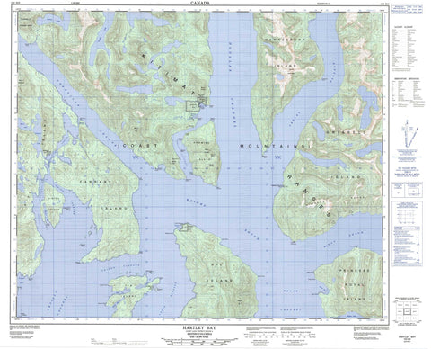
103H06 Hartley Bay Canada topo map, 1:50,000 scale
103H06 Hartley Bay NRCAN topographic map.
Includes UTM and GPS geographic coordinates (latitude and longitude). This 50k scale map is suitable for hiking, camping, and exploring, or you could frame it as a wall map.
Printed on-demand using high resolution, on heavy weight and acid free paper, or as an upgrade on a variety of synthetic materials.
Topos available on paper, Waterproof, Poly, or Tyvek. Usually shipping rolled, unless combined with other folded maps in one order.
- Product Number: NRCAN-103H06
- Parent Topo: TOPO-103H
- Map ID also known as: 103H06, 103H6
- Unfolded Size: Approximately 26" high by 36" wide
- Weight (paper map): ca. 55 grams
- Map Type: POD NRCAN Topographic Map
- Map Scale: 1:50,000
- Geographical region: British Columbia, Canada
Neighboring Maps:
All neighboring Canadian topo maps are available for sale online at 1:50,000 scale.
Purchase the smaller scale map covering this area: Topo-103H
Spatial coverage:
Topo map sheet 103H06 Hartley Bay covers the following places:
- Brant Bay - Coghlan Anchorage - Curlew Bay - Fisherman Cove - Hartley Bay - Hawk Bay - Home Bay - Malsey Bay - Minnis Bay - Mitchell Cove - Black Fly Point - Blackfly Point - Block Head - Blossom Point - Brodie Point - Buckle Point - Camp Point - Cape Farewell - Corbett Point - Davenport Point - Dawson Point - Hale Point - Halsey Point - Jenkinson Point - Juan Point - Leading Point - Letitia Point - Maple Point - Mollison Point - Money Point - Mosley Point - Nelly Point - Nessie Point - Observation Point - Plover Point - Point Cumming - Sainty Point - Stephens Point - Sutton Point - Swirl Point - Thom Point - Transit Point - Trivett Point - Turtle Point - Waterman Point - Wilman Point - Yolk Point - Cridge Passage - Douglas Channel - Grenville Channel - Hawkins Narrows - Hoey Narrows - Lewis Passage - Payne Channel - Peters Narrows - Stewart Narrows - Union Passage - Verney Passage - Whale Channel - Wright Sound - Gribble Island Indian Reserve 10 - Kulkayu (Hartley Bay) Indian Reserve 4 - Kulkayu (Hartley Bay) Indian Reserve 4A - Lachkul-jeets Indian Reserve 6 - Réserve indienne Gribble Island 10 - Réserve indienne Kulkayu (Hartley Bay) 4 - Réserve indienne Kulkayu (Hartley Bay) 4A - Réserve indienne Lachkul-jeets 6 - Réserve indienne Tsimtack 7 - Réserve indienne Turtle Point 12 - Tsimtack Indian Reserve 7 - Turtle Point Indian Reserve 12 - Ascroft Islet - Blenkinsop Islet - EdwardsIslet - Farrant Island - Fin Island - Gil Island - Gribbell Island - Hawkesbury Island - Hinton Island - Howard Islet - Pitt Island - Princess Royal Island - Promise Island - Belowe Lake - Gamble Lake - Lower Lake - Moore Lake - Tsimtack Lake - Whalen Lake - Chaîne Côtière - Coast Mountains - Countess of Dufferin Range - Kitimat Ranges - Mount Brodie - Mount Frye - Mount Gil - Mount Jenkinson - Mount Patterson - Mount Pitt - Mount Pocock - Mount Smiles - Mount White - Wimbledon Mountains - Wimbledon Range - Regional District of Kitimat-Stikine - Union Passage Marine Park - Belowe Creek - Gabion River - Whalen Creek - McKay Reach - Betton Rocks - Gil Rock - Harbour Rock - Otter Shoal - Hartley Bay


