
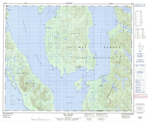
103H03 Gil Island Canada topo map, 1:50,000 scale
103H03 Gil Island NRCAN topographic map.
Includes UTM and GPS geographic coordinates (latitude and longitude). This 50k scale map is suitable for hiking, camping, and exploring, or you could frame it as a wall map.
Printed on-demand using high resolution, on heavy weight and acid free paper, or as an upgrade on a variety of synthetic materials.
Topos available on paper, Waterproof, Poly, or Tyvek. Usually shipping rolled, unless combined with other folded maps in one order.
- Product Number: NRCAN-103H03
- Parent Topo: TOPO-103H
- Map ID also known as: 103H03, 103H3
- Unfolded Size: Approximately 26" high by 36" wide
- Weight (paper map): ca. 55 grams
- Map Type: POD NRCAN Topographic Map
- Map Scale: 1:50,000
- Geographical region: British Columbia, Canada
Neighboring Maps:
All neighboring Canadian topo maps are available for sale online at 1:50,000 scale.
Purchase the smaller scale map covering this area: Topo-103H
Spatial coverage:
Topo map sheet 103H03 Gil Island covers the following places:
- Barnard Harbour - Betteridge Inlet - Cameron Cove - Cornwall Inlet - Crane Bay - Dillon Bay - Drummond Bay - Fish Bay - MacDonald Bay - McMicking Inlet - River Bight - Rivers Bight - Taylor Bight - Weinberg Inlet - Allatt Point - Barlow Point - Blackrock Point - Claudet Point - Dougan Point - Fanny Point - Fawcett Point - Fernyhough Point - Flett Point - Goodfellow Point - Jewsbury Peninsula - Keld Point - Leading Point - Leighton Point - Levy Point - McNeill Point - Molly Point - Redfern Point - Salmon Point - Seabrook Point - Shrub Point - Uren Point - York Point - Aikman Passage - Burnes Passage - Campania Sound - Casanave Passage - Estevan Sound - Lewis Passage - Otter Channel - Squally Channel - Whale Channel - Citeyats Indian Reserve 9 - Kahas Indian Reserve 7 - Kayel Indian Reserve 8 - Kunhunoan Indian Reserve 13 - Maple Point Indian Reserve 11 - Réserve indienne Citeyats 9 - Réserve indienne Kahas 7 - Réserve indienne Kayel 8 - Réserve indienne Kunhunoan 13 - Réserve indienne Maple Point 11 - Ashdown Island - Borde Island - Camp Islet - Campania Island - Cherry Islets - Fin Island - Gil Island - Hale Islet - Pitt Island - Princess Royal Island - Skinner Islands - Williams Islet - Deer Lake - Waterfall Lake - Whalen Lake - Eberts Range - Kitimat Ranges - Mount Cardin - Mount Pender - Murphy Range - Regional District of Kitimat-Stikine - Barnard Creek - Curtis Creek - Surf River - Waterfall Creek - Whalen Creek - Clement Rapids - Betton Rocks - Cartwright Rocks - Fin Rock - Logan Rock


