
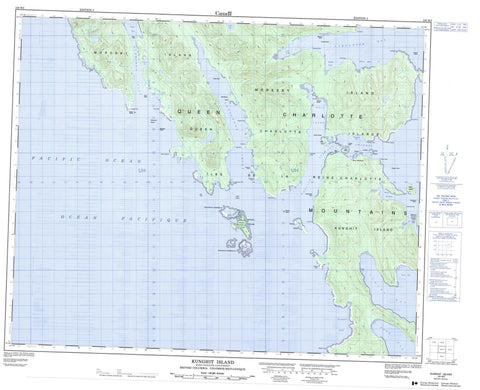
103B03 Kunghit Island Canada topo map, 1:50,000 scale
103B03 Kunghit Island NRCAN topographic map.
Includes UTM and GPS geographic coordinates (latitude and longitude). This 50k scale map is suitable for hiking, camping, and exploring, or you could frame it as a wall map.
Printed on-demand using high resolution, on heavy weight and acid free paper, or as an upgrade on a variety of synthetic materials.
Topos available on paper, Waterproof, Poly, or Tyvek. Usually shipping rolled, unless combined with other folded maps in one order.
- Product Number: NRCAN-103B03
- Parent Topo: TOPO-103B
- Map ID also known as: 103B03, 103B3
- Unfolded Size: Approximately 26" high by 36" wide
- Weight (paper map): ca. 55 grams
- Map Type: POD NRCAN Topographic Map
- Map Scale: 1:50,000
- Geographical region: British Columbia, Canada
Neighboring Maps:
All neighboring Canadian topo maps are available for sale online at 1:50,000 scale.
Purchase the smaller scale map covering this area: Topo-103B
Spatial coverage:
Topo map sheet 103B03 Kunghit Island covers the following places:
- Anvil Cove - Balcom Inlet - Carpenter Bay - Flamingo Inlet - Gilbert Bay - Grays Cove - Heater Harbour - Howe Bay - Huston Inlet - Koya Bay - Louscoone Inlet - Luxana Bay - Raspberry Cove - Rose Harbour - Rose Inlet - Short Inlet - Small Cove - South Cove - Sperm Bay - Staki Bay - Treat Bay - Arnold Point - Barber Point - Blackburn Peninsula - Bowles Point - Cadman Point - Cape Fanny - Cape Freeman - Catherine Point - Crooked Point - Etches Point - Forsyth Point - Gaowina Point - Hancock Point - Hornby Point - Ingraham Point - Iron Point - Kendrick Point - Kiju Point - Koya Point - Larsen Point - Louscoone Point - McLean Fraser Point - Moore Head - Nagas Point - Ninstints Point - Orion Point - Point Langford - Snub Point - Staki Point - Tuga Point - Gaudin Passage - Houston Stewart Channel - Réserve indienne Metso A Choot 23 - Tsaz Cheh Koh Indian Reserve 24 - Annette Island - Anthony Island - Charles Islands - Ellen Island - Fairfax Island - Flat Rock Island - Flatrock Island - Gordon Islands - High Island - Îles de la Reine-Charlotte - Kunghit Island - Langtry Island - Moresby Island - Queen Charlotte Islands - Ross Island - Skindaskun Island - Shrimp Lake - Queen Charlotte Mountains - Anthony Island (South Moresby) World Heritage Site - Anthony Island Park - Gwaii Haanas National Park Reserve and Haida Heritage Site - Lieu historique national du Canada de Nan Sdins - Nan Sdins National Historic Site of Canada - Réserve de parc national et site du patrimoine haïda Gwaii Haanas - SGang Gwaay World Heritage Site - Site du patrimoine mondial de l'Île Anthony (Moresby-Sud) - Site du patrimoine mondial SGang Gwaay - Fanny Creek - Sedmond Creek - Sedmond River - Shrimp Creek - Adam Rocks - Anvil Rock - Billington Rocks - Crowell Rock - Denny Rocks - Germania Rock - Haydon Rock - Head Rock - Henderson Rocks - Ibbertson Banks - Langford Shoals - MacLeod Shoal - Nagas Rocks - Pincher Rocks - Quadra Rocks - Samuel Rock - Sargison Reef - Trevan Rock - Washington Rock - Ninstints - Rose Harbour


