
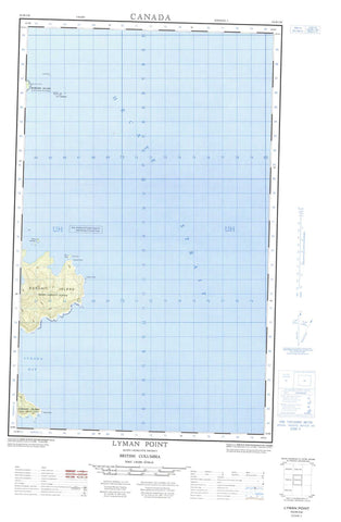
103B02W Lyman Point Canada topo map, 1:50,000 scale
103B02W Lyman Point NRCAN topographic map.
Includes UTM and GPS geographic coordinates (latitude and longitude). This 50k scale map is suitable for hiking, camping, and exploring, or you could frame it as a wall map.
Printed on-demand using high resolution, on heavy weight and acid free paper, or as an upgrade on a variety of synthetic materials.
Topos available on paper, Waterproof, Poly, or Tyvek. Usually shipping rolled, unless combined with other folded maps in one order.
- Halfsheet: This map was designed as a half sheet of NRCAN-103B02, and it is the Western half. Find the eastern half sheet here.
- Product Number: NRCAN-103B02W
- Parent Topo: TOPO-103B
- Map ID also known as: 103B02, 103B2
- Unfolded Size: Approximately 26" high by 36" wide
- Weight (paper map): ca. 55 grams
- Map Type: POD NRCAN Topographic Map
- Map Scale: 1:50,000
- Geographical region: British Columbia, Canada
Neighboring Maps:
All neighboring Canadian topo maps are available for sale online at 1:50,000 scale.
Purchase the smaller scale map covering this area: Topo-103B
Spatial coverage:
Topo map sheet 103B02W Lyman Point covers the following places:
- Keeweenah Bay - Luxana Bay - Montserrat Bay - Annis Point - Benjamin Point - Blackburn Peninsula - Gull Point - Jenkins Point - Lyman Point - Prevost Point - Hecate Strait - Gull Islet - Îles de la Reine-Charlotte - Kunghit Island - Marshall Island - Moresby Island - Queen Charlotte Islands - Rainy Islands - Gwaii Haanas National Park Reserve and Haida Heritage Site - Réserve de parc national et site du patrimoine haïda Gwaii Haanas - Christian Rock - Garcin Rocks - Grant Bank - Gull Banks - Huff Rock


