
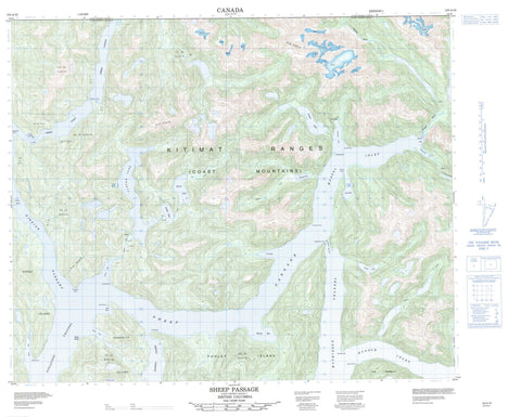
103A16 Sheep Passage Canada topo map, 1:50,000 scale
103A16 Sheep Passage NRCAN topographic map.
Includes UTM and GPS geographic coordinates (latitude and longitude). This 50k scale map is suitable for hiking, camping, and exploring, or you could frame it as a wall map.
Printed on-demand using high resolution, on heavy weight and acid free paper, or as an upgrade on a variety of synthetic materials.
Topos available on paper, Waterproof, Poly, or Tyvek. Usually shipping rolled, unless combined with other folded maps in one order.
- Product Number: NRCAN-103A16
- Parent Topo: TOPO-103A
- Map ID also known as: 103A16
- Unfolded Size: Approximately 26" high by 36" wide
- Weight (paper map): ca. 55 grams
- Map Type: POD NRCAN Topographic Map
- Map Scale: 1:50,000
- Geographical region: British Columbia, Canada
Neighboring Maps:
All neighboring Canadian topo maps are available for sale online at 1:50,000 scale.
Purchase the smaller scale map covering this area: Topo-103A
Spatial coverage:
Topo map sheet 103A16 Sheep Passage covers the following places:
- Bolin Bay - Carter Bay - David Bay - Desbrisay Bay - Goat Cove - Green Inlet - Heathorn Bay - Horsefly Cove - Kid Bay - Kynoch Inlet - Mussel Bay - Mussel Inlet - Oatswish Bay - Poison Cove - Windy Bay - Work Bay - Adze Point - Baffle Point - Barrie Point - Carse Point - Carter Point - Crosson Point - Fawn Point - Finlayson Head - Garvey Point - Kynoch Point - Lime Point - Mathieson Point - Netherby Point - Beauchemin Channel - Finlayson Channel - Griffin Passage - Hiekish Narrows - Mathieson Channel - Mathieson Narrows - Sheep Passage - Goat Bluff - Oatswish Indian Reserve 13 - Réserve indienne Oatswish 13 - Hewitt Island - Pooley Island - Roderick Island - Sarah Island - Thomas Islet - Carter Lake - David Lake - Green Lagoon - Hallet Lake - Korich Lake - Lizette Lake - McAlpin Lake - Wallace Lake - Chaîne Côtière - Coast Mountains - Kitimat Ranges - Regional District of Kitimat-Stikine - Fiordland Recreation Area - Green Inlet Marine Park - Carter River - Feeder Creek - Joe Creek - Lessum Creek - Lizette Creek - McAlpin Creek - Mussel River - Oriental Creek - Poison Cove Creek - Hewitt Rock - Ohio Rock


