
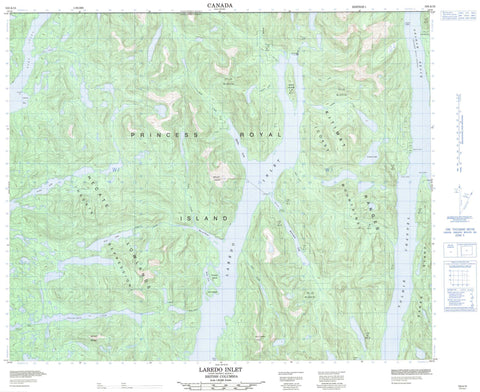
103A15 Laredo Inlet Canada topo map, 1:50,000 scale
103A15 Laredo Inlet NRCAN topographic map.
Includes UTM and GPS geographic coordinates (latitude and longitude). This 50k scale map is suitable for hiking, camping, and exploring, or you could frame it as a wall map.
Printed on-demand using high resolution, on heavy weight and acid free paper, or as an upgrade on a variety of synthetic materials.
Topos available on paper, Waterproof, Poly, or Tyvek. Usually shipping rolled, unless combined with other folded maps in one order.
- Product Number: NRCAN-103A15
- Parent Topo: TOPO-103A
- Map ID also known as: 103A15
- Unfolded Size: Approximately 26" high by 36" wide
- Weight (paper map): ca. 55 grams
- Map Type: POD NRCAN Topographic Map
- Map Scale: 1:50,000
- Geographical region: British Columbia, Canada
Neighboring Maps:
All neighboring Canadian topo maps are available for sale online at 1:50,000 scale.
Purchase the smaller scale map covering this area: Topo-103A
Spatial coverage:
Topo map sheet 103A15 Laredo Inlet covers the following places:
- Adams Bay - Alston Cove - Bay of Plenty - Cougar Bay - Fifer Cove - Helmcken Inlet - Kamin Cove - Laredo Inlet - Mellis Inlet - Peen Harbour - Penn Harbour - Surf Inlet - Weld Cove - Adams Point - Flat Point - Hook Point - Quarry Point - Sarah Head - Tolmie Point - Tuite Point - Beauchemin Channel - Princess Royal Channel - Tolmie Channel - Réserve indienne Saint Joe 10 - Réserve indienne Ulthakoush 11 - Saint Joe Indian Reserve 10 - Ulthakoush Indian Reserve 11 - Brew Island - Carroll Island - Hewitt Island - Kohl Island - Pocock Island - Princess Royal Island - Sarah Island - Archie Lake - Bloomfield Lake - Helmcken Lake - Lomax Lake - Pyne Lake - Chaîne Côtière - Coast Mountains - Irving Mountain - Kitimat Ranges - Mount Irving - Mount Parry - North Needle Peak - Parry Mountain - Regional District of Kitimat-Stikine - Arnoup Creek - Buie Creek - Busey Creek - Dally Creek - Goin Creek - Hards Creek - Kamin Creek - Lomax Creek - Nias Creek - Otty Creek - Packe Creek - Peatt Creek - Pyne Creek - Ronald Creek - Tyler Creek - Graham Reach - Burr Rock


