
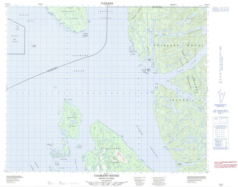
103A14 Caamano Sound Canada topo map, 1:50,000 scale
103A14 Caamano Sound NRCAN topographic map.
Includes UTM and GPS geographic coordinates (latitude and longitude). This 50k scale map is suitable for hiking, camping, and exploring, or you could frame it as a wall map.
Printed on-demand using high resolution, on heavy weight and acid free paper, or as an upgrade on a variety of synthetic materials.
Topos available on paper, Waterproof, Poly, or Tyvek. Usually shipping rolled, unless combined with other folded maps in one order.
- Product Number: NRCAN-103A14
- Parent Topo: TOPO-103A
- Map ID also known as: 103A14
- Unfolded Size: Approximately 26" high by 36" wide
- Weight (paper map): ca. 55 grams
- Map Type: POD NRCAN Topographic Map
- Map Scale: 1:50,000
- Geographical region: British Columbia, Canada
Neighboring Maps:
All neighboring Canadian topo maps are available for sale online at 1:50,000 scale.
Purchase the smaller scale map covering this area: Topo-103A
Spatial coverage:
Topo map sheet 103A14 Caamano Sound covers the following places:
- Argyh Cove - Bone Anchorage - Carne Bay - Chapple Inlet - Clarke Cove - Commando Inlet - Doig Anchorage - Emily Carr Inlet - Evinrude Inlet - Helmcken Inlet - Kiln Bay - Racey Inlet - Surf Inlet - Baker Point - Bryant Point - Chettleburgh Point - Eclipse Point - Hawkins Peninsula - Hawkins Point - Johnstone Point - Mallandaine Point - McKechnie Point - McPhee Point - Oswald Point - Pearse Point - Ulric Point - Caamaño Sound - Campania Sound - Estevan Sound - Holgate Passage - Laredo Channel - Leadman Passage - Meiss Passage - Parker Passage - Lackzuswadda Indian Reserve 9 - Réserve indienne Lackzuswadda 9 - Alexander Islands - Anderson Islands - Aristazabal Island - Baile Island - Beaven Islands - Campania Island - Duckers Islands - Dupont Island - Glide Islands - Hicks Island - Jay Islands - Princess Royal Island - Rennison Island - Sager Islands - Smithers Island - Tuzo Islands - Wale Island - Wall Islands - Walls Islands - Webber Island - Coast Mountains - Kitimat Ranges - Knight Range - Mount Parizeau - Murphy Range - Nob Hill - Regional District of Kitimat-Stikine - Blinder Rock - Cliffe Rock - Cox Rocks - Hallet Rock - Holler Rock - Laundy Rock - Morehouse Rock - Shakespeare Banks - Wearmouth Rock - Woods Shoal


