
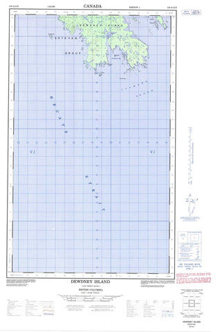
103A13E Dewdney Island Canada topo map, 1:50,000 scale
103A13E Dewdney Island NRCAN topographic map.
Includes UTM and GPS geographic coordinates (latitude and longitude). This 50k scale map is suitable for hiking, camping, and exploring, or you could frame it as a wall map.
Printed on-demand using high resolution, on heavy weight and acid free paper, or as an upgrade on a variety of synthetic materials.
Topos available on paper, Waterproof, Poly, or Tyvek. Usually shipping rolled, unless combined with other folded maps in one order.
- Halfsheet: This map was designed as a half sheet of NRCAN-103A13, and it is the Eastern half. Find the western half sheet here.
- Product Number: NRCAN-103A13E
- Parent Topo: TOPO-103A
- Map ID also known as: 103A13
- Unfolded Size: Approximately 26" high by 36" wide
- Weight (paper map): ca. 55 grams
- Map Type: POD NRCAN Topographic Map
- Map Scale: 1:50,000
- Geographical region: British Columbia, Canada
Neighboring Maps:
All neighboring Canadian topo maps are available for sale online at 1:50,000 scale.
Purchase the smaller scale map covering this area: Topo-103A
Spatial coverage:
Topo map sheet 103A13E Dewdney Island covers the following places:
- Gillen Harbour - Pemberton Bay - Goodacre Point - Thomson Point - Caamaño Sound - Hecate Strait - Adams Island - Carne Island - Dewdney Island - Estevan Group - Estevan Islands - Hickey Islands - Jacinto Islands - Macdonald Island - Peatt Islets - Porter Island - South Island - Regional District of Kitimat-Stikine - Aranzazu Banks - Borthwick Rock - Cort Rock - Cran Shoal - Estevan Reef - Evans Rock - Janion Rock - Ness Rock - Robertson Rock - Sage Rock - Shannon Rock - Spencer Bank - Yates Shoal


