
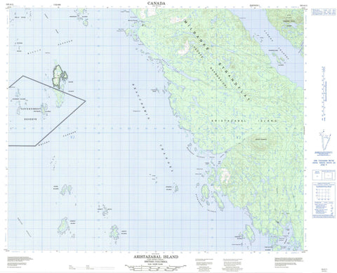
103A11 Aristazabal Island Canada topo map, 1:50,000 scale
103A11 Aristazabal Island NRCAN topographic map.
Includes UTM and GPS geographic coordinates (latitude and longitude). This 50k scale map is suitable for hiking, camping, and exploring, or you could frame it as a wall map.
Printed on-demand using high resolution, on heavy weight and acid free paper, or as an upgrade on a variety of synthetic materials.
Topos available on paper, Waterproof, Poly, or Tyvek. Usually shipping rolled, unless combined with other folded maps in one order.
- Product Number: NRCAN-103A11
- Parent Topo: TOPO-103A
- Map ID also known as: 103A11
- Unfolded Size: Approximately 26" high by 36" wide
- Weight (paper map): ca. 55 grams
- Map Type: POD NRCAN Topographic Map
- Map Scale: 1:50,000
- Geographical region: British Columbia, Canada
Neighboring Maps:
All neighboring Canadian topo maps are available for sale online at 1:50,000 scale.
Purchase the smaller scale map covering this area: Topo-103A
Spatial coverage:
Topo map sheet 103A11 Aristazabal Island covers the following places:
- Bent Harbour - Borrowman Bay - Clifford Bay - Kent Inlet - Kettle Inlet - Switzer Cove - Tate Cove - Turtish Harbour - Weeteeam Bay - Breakenridge Point - Deasy Point - Fox Point - Loap Point - Meade Point - Shotbolt Point - Wriglesworth Point - Beauchemin Channel - Hecate Strait - Laredo Channel - Leadman Passage - Meiss Passage - Morison Passage - Philip Narrows - Willis Passage - Wright Passage - Gander Island Indian Reserve 14 - Kdad-eesh Indian Reserve 4 - Réserve indienne Gander Island 14 - Réserve indienne Kdad-eesh 4 - Réserve indienne Weeteeam 3 - Weeteeam Indian Reserve 3 - Alman Island - Anderson Islands - Archer Islets - Aristazabal Island - Arriaga Islands - Babbage Island - Benney Islets - Bowden Islands - Bruce Islet - Byers Islands - Conroy Island - Craft Island - Dobbs Islets - Harvey Islands - Howse Island - Louis Islands - McKenney Islands - Moore Islands - Normansell Islands - Princess Royal Island - Ramsbotham Islands - Sinnett Islets - South Arriaga Island - Tarte Island - Thistleton Islands - Thomson Island - Trenaman Island - Trickey Islands - Wall Islets - Whitmore Islands - Wilks Island - Woodcock Islands - Noble Lagoon - Mount Gillespie - Mount Johnston - Regional District of Kitimat-Stikine - Clifford Creek - Duffey Creek - Flux Creek - Kdelmashan Creek - Stannard Creek - Allen Rocks - Baker Shoal - Bonson Rock - Bridgeman Rock - Butler Shoal - Carter Rocks - Christie Shoal - Digby Rock - Eaton Rock - Hawkins Rock - Hazel Shoal - Howell Rock - Keith Rock - Knarston Rock - Liddell Rocks - Lindsay Rocks - Lombard Rocks - McColl Rock - McGowen Rocks - Mesher Rock - Raby Rock - Richards Shoal - Russell Banks - Schram Rocks - Sehl Rock - Sere Rock - Soar Rock - Thurgate Rock - Turner Rock - Verdier Shoal - Wakely Rock - Wall Rocks - Wells Rocks


