
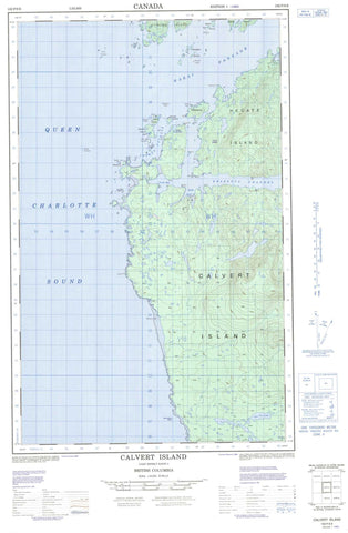
102P09E Calvert Island Canada topo map, 1:50,000 scale
102P09E Calvert Island NRCAN topographic map.
Includes UTM and GPS geographic coordinates (latitude and longitude). This 50k scale map is suitable for hiking, camping, and exploring, or you could frame it as a wall map.
Printed on-demand using high resolution, on heavy weight and acid free paper, or as an upgrade on a variety of synthetic materials.
Topos available on paper, Waterproof, Poly, or Tyvek. Usually shipping rolled, unless combined with other folded maps in one order.
- Halfsheet: This map was designed as a half sheet of NRCAN-102P09, and it is the Eastern half. Find the western half sheet here.
- Product Number: NRCAN-102P09E
- Parent Topo: TOPO-102P
- Map ID also known as: 102P09, 102P9
- Unfolded Size: Approximately 26" high by 36" wide
- Weight (paper map): ca. 55 grams
- Map Type: POD NRCAN Topographic Map
- Map Scale: 1:50,000
- Geographical region: British Columbia, Canada
Neighboring Maps:
All neighboring Canadian topo maps are available for sale online at 1:50,000 scale.
Purchase the smaller scale map covering this area: Topo-102P
Spatial coverage:
Topo map sheet 102P09E Calvert Island covers the following places:
- Adams Harbour - Bolivar Islet - Goldstream Harbour - Keith Anchorage - Pruth Bay - Queen Charlotte Sound - Barney Point - Dublin Point - Hawser Point - Odlum Point - Sandspit Point - Whittaker Point - Choked Passage - Hakai Passage - Kwakshua Channel - Boas Islet - Breaker Group - Calvert Island - Donald Island - Flat Islands - Hecate Island - Jupiter Island - Leading Island - Lower Island - Lower Islands - Mars Islet - Meay Islet - Mercury Islet - Odlum Island - Planet Group - Rattenbury Island - Starfish Island - Stirling Island - Surf Islands - Chic Chic Lake - Stony Saddle - Central Coast Regional District - Hakai Recreation Area - Big Spring Creek - Breaker Ledge - Carrington Reef - Codfish Rock - Evening Rock - Fairway Rock - Fitz Roy Reef - Foster Rocks - Mainguy Rock - North Pointers Rocks - Port Reef - South Pointers Rocks - Starfish Ledge


