
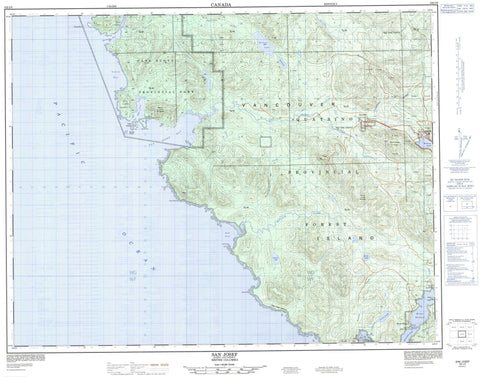
102I09 San Josef Canada topo map, 1:50,000 scale
102I09 San Josef NRCAN topographic map.
Includes UTM and GPS geographic coordinates (latitude and longitude). This 50k scale map is suitable for hiking, camping, and exploring, or you could frame it as a wall map.
Printed on-demand using high resolution, on heavy weight and acid free paper, or as an upgrade on a variety of synthetic materials.
Topos available on paper, Waterproof, Poly, or Tyvek. Usually shipping rolled, unless combined with other folded maps in one order.
- Product Number: NRCAN-102I09
- Parent Topo: TOPO-102I
- Map ID also known as: 102I09, 102I9
- Unfolded Size: Approximately 26" high by 36" wide
- Weight (paper map): ca. 55 grams
- Map Type: POD NRCAN Topographic Map
- Map Scale: 1:50,000
- Geographical region: British Columbia, Canada
Neighboring Maps:
All neighboring Canadian topo maps are available for sale online at 1:50,000 scale.
Purchase the smaller scale map covering this area: Topo-102I
Spatial coverage:
Topo map sheet 102I09 San Josef covers the following places:
- Browning Inlet - Forward Inlet - Grant Bay - Hansen Bay - Holberg Inlet - Leeson Harbour - Lowrie Bay - North Harbour - Raft Cove - San Josef Bay - Sea Otter Cove - Winter Harbour - Cape Palmerston - Cape Russell - Commerell Point - Greenwood Point - Hanna Point - Hazard Point - Lippy Point - Montgomery Point - Topknot Point - Topnot Point - Clienna Indian Reserve 14 - Grass Point Indian Reserve 13 - Quatleyo Indian Reserve 12 - Réserve indienne Clienna 14 - Réserve indienne Grass Point 13 - Réserve indienne Quatleyo 12 - Réserve indienne Semach 2 - Semach Indian Reserve 2 - Helen Islands - Hunt Islets - Île de Vancouver - Kelley Island - Matthews Island - Pinnacle Island - Vancouver Island - Wedel Island - Winifred Islands - Brink Lake - Eric Lake - Erie Lake - Leeson Lake - Ludvig Lake - Moore Lake - Soren Lake - Topknot Lake - William Lake - Canadian Forces Station Holberg - Station des Forces canadiennes Holberg - Flat Top Mountain - Mount Brandes - Mount Hansen - Mount Ho - Mount St. Patrick - Plumper Hill - Regional District of Mount Waddington - Cape Scott Park - Raft Cove Park - Denad Creek - Fisherman River - Galato Creek - Goodspeed River - Jensen Creek - Kwatleo Creek - Kwatleo Creek - Leeson Creek - Macjack River - Obling Creek - Quashtin Creek - Rasmus Creek - Ronning Creek - Russell Creek - San Josef River - Sharp Creek - St. Mary Creek - St. Patrick Creek - Stranby River - Strandby River - Bushby Rock - Strange Rock - Elephant Crossing - Holberg - San Josef - San Josef Bay - Winter Harbour


