
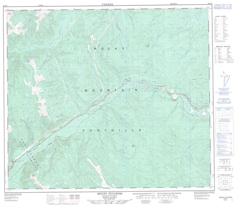
093O09 Mount Hulcross Canada topo map, 1:50,000 scale
093O09 Mount Hulcross NRCAN topographic map.
Includes UTM and GPS geographic coordinates (latitude and longitude). This 50k scale map is suitable for hiking, camping, and exploring, or you could frame it as a wall map.
Printed on-demand using high resolution, on heavy weight and acid free paper, or as an upgrade on a variety of synthetic materials.
Topos available on paper, Waterproof, Poly, or Tyvek. Usually shipping rolled, unless combined with other folded maps in one order.
- Product Number: NRCAN-093O09
- Parent Topo: TOPO-093O
- Map ID also known as: 093O09, 93O9, 93O09
- Unfolded Size: Approximately 26" high by 36" wide
- Weight (paper map): ca. 55 grams
- Map Type: POD NRCAN Topographic Map
- Map Scale: 1:50,000
- Geographical region: British Columbia, Canada
Neighboring Maps:
All neighboring Canadian topo maps are available for sale online at 1:50,000 scale.
Purchase the smaller scale map covering this area: Topo-093O
Spatial coverage:
Topo map sheet 093O09 Mount Hulcross covers the following places:
- Bickford Lake - Dokie Ridge - Falls Mountain - Mount Bickford - Mount Hulcross - Mount Monteith - Murray Range - Pyramis Peak - Rocky Mountain Foothills - Peace River Regional District - Alvin Creek - Beaudette Creek - Big Boulder Creek - Browns Creek - Cleveland Creek - Coyote Creek - Crassier Creek - Falling Creek - Fisher Creek - Frank Roy Creek - Fred Nelson Creek - Fur Thief Creek - Hasler Creek - Highrise Creek - Hulcross Creek - Ivorline Creek - Johnsen Creek - Johnson Creek - Le Moray Creek - Little Boulder Creek - Moberly River - Pine River - Rocket Creek - Shangweshi Creek - Willow Creek - Falls - Hulcross - Lemoray - Pine Valley


