
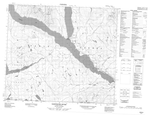
093N04 Sakeniche River Canada topo map, 1:50,000 scale
093N04 Sakeniche River NRCAN topographic map.
Includes UTM and GPS geographic coordinates (latitude and longitude). This 50k scale map is suitable for hiking, camping, and exploring, or you could frame it as a wall map.
Printed on-demand using high resolution, on heavy weight and acid free paper, or as an upgrade on a variety of synthetic materials.
Topos available on paper, Waterproof, Poly, or Tyvek. Usually shipping rolled, unless combined with other folded maps in one order.
- Product Number: NRCAN-093N04
- Parent Topo: TOPO-093N
- Map ID also known as: 093N04, 93N4, 93N04
- Unfolded Size: Approximately 26" high by 36" wide
- Weight (paper map): ca. 55 grams
- Map Type: POD NRCAN Topographic Map
- Map Scale: 1:50,000
- Geographical region: British Columbia, Canada
Neighboring Maps:
All neighboring Canadian topo maps are available for sale online at 1:50,000 scale.
Purchase the smaller scale map covering this area: Topo-093N
Spatial coverage:
Topo map sheet 093N04 Sakeniche River covers the following places:
- Northwest Arm - Takla Narrows - Réserve indienne Teh Noo'n Che 49 - Teh Noo'n Che 49 - Teh Noo'n Che Indian Reserve 49 - Natowite Lake - Takla Lake - Tochcha Lake - Hogem Ranges - Mitchell Range - Mount Blanchet - Nalcus Mountain - Omineca Mountains - Spike Peak - Takla Range - Regional District of Bulkley-Nechako - Takla Lake Marine Park - Nechako Plateau - Bivouac Creek - Leo Creek - Middle River - Rainbow Creek - Sakeniche River - Tsitsutl Creek - Leo Creek


