
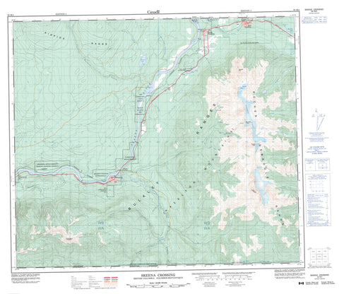
093M04 Skeena Crossing Canada topo map, 1:50,000 scale
093M04 Skeena Crossing NRCAN topographic map.
Includes UTM and GPS geographic coordinates (latitude and longitude). This 50k scale map is suitable for hiking, camping, and exploring, or you could frame it as a wall map.
Printed on-demand using high resolution, on heavy weight and acid free paper, or as an upgrade on a variety of synthetic materials.
Topos available on paper, Waterproof, Poly, or Tyvek. Usually shipping rolled, unless combined with other folded maps in one order.
- Product Number: NRCAN-093M04
- Parent Topo: TOPO-093M
- Map ID also known as: 093M04, 93M4, 93M04
- Unfolded Size: Approximately 26" high by 36" wide
- Weight (paper map): ca. 55 grams
- Map Type: POD NRCAN Topographic Map
- Map Scale: 1:50,000
- Geographical region: British Columbia, Canada
Neighboring Maps:
All neighboring Canadian topo maps are available for sale online at 1:50,000 scale.
Purchase the smaller scale map covering this area: Topo-093M
Spatial coverage:
Topo map sheet 093M04 Skeena Crossing covers the following places:
- New Hazelton - Sawmill Glacier - Silvertip Glacier - Silvertip Icefield - Andimaul Indian Reserve 1 - Gitanmaax Indian Reserve 1 - Gitsegukla Indian Reserve 1 - Gitsegukla Logging Indian Reserve 3 - Kitseguecla Indian Reserve 1 - Kitsegukla Logging Indian Reserve 3 - New Gitsegukla Indian Reserve 2 - New Kitseguecla Indian Reserve 2 - Réserve indienne Andimaul 1 - Réserve indienne Gitanmaax 1 - Réserve indienne Gitsegukla 1 - Réserve indienne Gitsegukla Logging 3 - Réserve indienne Kitseguecla 1 - Réserve indienne Kitsegukla Logging 3 - Réserve indienne New Gitsegukla 2 - Réserve indienne New Kitseguecla 2 - Bell Lake - Keynton Lake - Rossvale Lake - Seeley Lake - Stikyadin Lake - Brian Boru Peak - Bulkley Ranges - Hagwilget Peak - Hazelton Mountains - Kispiox Range - Kitseguecla Mountain - Red Rose Peak - Rocher Déboulé Mountains - Rocher Déboulé Range - Stikyadin Mountains - Tiltusha Peak - Regional District of Kitimat-Stikine - Bulkley Junction Park - Seeley Lake Park - Ants Nest Riffle - Andi Creek - Armagosa Creek - Boulder Creek - Brian Boru Creek - Bulkley River - Bunker Creek - Burdick Creek - Chicago Creek - Comeau Creek - Corya Creek - Deep Canyon Creek - Deep Gully Creek - East Shandilla Creek - Gershwin Creek - John Brown Creek - Juniper Creek - Keynton Creek - Kitseguecla River - Kitsuns Creek - McIntosh Landing Creek - Mudflat Creek - Porphyry Creek - Red Rose Creek - Shandilla Creek - Silvertip Creek - Skeena River - Slater Creek - Station Creek - Straw Creek - Waterfall Creek - Andimaul - Carnaby - Hazelton - Kitseguecla - 'Ksan - McLeod - Nash - Red Rose - Skeena Crossing - South Hazelton


