
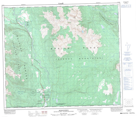
093M03 Moricetown Canada topo map, 1:50,000 scale
093M03 Moricetown NRCAN topographic map.
Includes UTM and GPS geographic coordinates (latitude and longitude). This 50k scale map is suitable for hiking, camping, and exploring, or you could frame it as a wall map.
Printed on-demand using high resolution, on heavy weight and acid free paper, or as an upgrade on a variety of synthetic materials.
Topos available on paper, Waterproof, Poly, or Tyvek. Usually shipping rolled, unless combined with other folded maps in one order.
- Product Number: NRCAN-093M03
- Parent Topo: TOPO-093M
- Map ID also known as: 093M03, 93M3, 93M03
- Unfolded Size: Approximately 26" high by 36" wide
- Weight (paper map): ca. 55 grams
- Map Type: POD NRCAN Topographic Map
- Map Scale: 1:50,000
- Geographical region: British Columbia, Canada
Neighboring Maps:
All neighboring Canadian topo maps are available for sale online at 1:50,000 scale.
Purchase the smaller scale map covering this area: Topo-093M
Spatial coverage:
Topo map sheet 093M03 Moricetown covers the following places:
- Babine Indian Reserve 17 - Babine Indian Reserve 18 - Bulkley Indian Reserve 1 - Bulkley River Indian Reserve 19 - Coryatsaqua (Moricetown) Indian Reserve 2 - Moricetown Indian Reserve 1 - Réserve indienne Babine 17 - Réserve indienne Babine 18 - Réserve indienne Bulkley 1 - Réserve indienne Bulkley River 19 - Réserve indienne Coryatsaqua (Moricetown) 2 - Réserve indienne Moricetown 1 - Duckbill Lake - Duckwing Lake - Babine Mountains - Babine Range - Blunt Mountain - Bulkley Ranges - Hazelton Mountains - Mount Seaton - Rocher Déboulé Range - Skeena Mountains - Regional District of Bulkley-Nechako - Regional District of Kitimat-Stikine - Boulder Creek Park - Netalzul Meadows Park - Interior Plateau - Mosquito Flat - Mosquito Flats - Nechako Plateau - Strawberry Flats - Armagosa Creek - Atrill Creek - Blunt Creek - Boulder Creek - Bulkley River - Bunker Creek - Camp Creek - Causqua Creek - China Creek - Chink Creek - Corduroy Creek - Corya Creek - Gramophone Creek - Graphite Creek - Harold Price Creek - John Brown Creek - Kwun Creek - Luno Creek - Mudflat Creek - Netalzul Creek - Porphyry Creek - Sharpe Creek - Skilokis Creek - Straw Creek - Suskwa River - Touhy Creek - Beament - Bulkley Canyon - Moricetown - Seaton


