
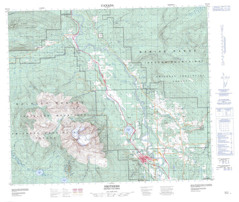
093L14 Smithers Canada topo map, 1:50,000 scale
093L14 Smithers NRCAN topographic map.
Includes UTM and GPS geographic coordinates (latitude and longitude). This 50k scale map is suitable for hiking, camping, and exploring, or you could frame it as a wall map.
Printed on-demand using high resolution, on heavy weight and acid free paper, or as an upgrade on a variety of synthetic materials.
Topos available on paper, Waterproof, Poly, or Tyvek. Usually shipping rolled, unless combined with other folded maps in one order.
- Product Number: NRCAN-093L14
- Parent Topo: TOPO-093L
- Map ID also known as: 093L14, 93L14
- Unfolded Size: Approximately 26" high by 36" wide
- Weight (paper map): ca. 55 grams
- Map Type: POD NRCAN Topographic Map
- Map Scale: 1:50,000
- Geographical region: British Columbia, Canada
Neighboring Maps:
All neighboring Canadian topo maps are available for sale online at 1:50,000 scale.
Purchase the smaller scale map covering this area: Topo-093L
Spatial coverage:
Topo map sheet 093L14 Smithers covers the following places:
- Hudson Bay Glacier - Toboggan Glacier - Oschawwinna Indian Reserve 3 - Réserve indienne Oschawwinna 3 - Aldrich Lake - Bigelow Lake - Call Lake - Dennis Lake - Frederick Lake - Kathlyn Lake - Schufer Lake - Seymour Lake - Silvern Lake - Toboggan Lake - Babine Mountains - Babine Range - Bulkley Ranges - Hazelton Mountains - Hudson Bay Mountain - Hudson Bay Range - Skeena Mountains - Regional District of Bulkley-Nechako - Regional District of Kitimat-Stikine - Babine Mountains Recreation Area - Call Lake Park - Driftwood Canyon Park - Hudson Bay Mountain - Beavery Creek - Bigelow Creek - Bulkley River - Can Brook - Canyon Creek - Chicken Lake Creek - Club Creek - Cow Creek - Cygnet Creek - Dahl Creek - Dahlie Creek - Driftwood Creek - Elliot Creek - Ganokwa Creek - Glacial Creek - Glacier Gulch - Glacier Gulch Creek - Glass Creek - Gramophone Creek - Halley Creek - Harold Price Creek - Henderson Creek - John Brown Creek - Kathlyn Creek - Maney Creek - Meed Creek - Miller Creek - Newitt Creek - Owens Creek - Passby Creek - Reiseter Creek - Schippers Creek - Seymour Creek - Silvern Creek - Simpson Creek - Sloan Creek - Spruce Camp Creek - Toboggan Creek - Trout Creek - Twin Creek - White Swan Creek - Wiggs Creek - Zymoetz River - Smithers - Doughty - Driftwood Creek - Evelyn - Glentanna - Lake Kathlyn - Seymour Lake - Glacier Gulch


