
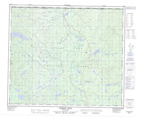
093K16 Tezzeron Creek Canada topo map, 1:50,000 scale
093K16 Tezzeron Creek NRCAN topographic map.
Includes UTM and GPS geographic coordinates (latitude and longitude). This 50k scale map is suitable for hiking, camping, and exploring, or you could frame it as a wall map.
Printed on-demand using high resolution, on heavy weight and acid free paper, or as an upgrade on a variety of synthetic materials.
Topos available on paper, Waterproof, Poly, or Tyvek. Usually shipping rolled, unless combined with other folded maps in one order.
- Product Number: NRCAN-093K16
- Parent Topo: TOPO-093K
- Map ID also known as: 093K16, 93K16
- Unfolded Size: Approximately 26" high by 36" wide
- Weight (paper map): ca. 55 grams
- Map Type: POD NRCAN Topographic Map
- Map Scale: 1:50,000
- Geographical region: British Columbia, Canada
Neighboring Maps:
All neighboring Canadian topo maps are available for sale online at 1:50,000 scale.
Purchase the smaller scale map covering this area: Topo-093K
Spatial coverage:
Topo map sheet 093K16 Tezzeron Creek covers the following places:
- Lhoh Cho 29 - Lhoh Cho Indian Reserve 29 - Réserve indienne Lhoh Cho 29 - 28 Mile Lake - Benoit Lakes - Bunghun Whucho Lake - Bunghunyaz Lake - Chuzkeepah Lake - Cripple Lake - Dem Lake - Destlay Lake - Dolphin Lake - Hat Lake - Inzana Lake - Kalder Lake - Lho Duchooz Lake - Nendatoo Lake - Otterson Lake - Tezzeron Lake - Sasklo Dome - Sasklo Ridge - Regional District of Bulkley-Nechako - Regional District of Fraser-Fort George - Butchers Flat - Interior Plateau - Nechako Plateau - Cripple Creek - Hatdudatehl Creek - Kilner Creek - Kleedlee Creek - Taslincheko Creek - Tezzeron Creek - Tsilcoh River - Willowy Creek


