
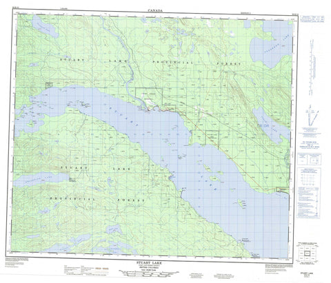
093K10 Stuart Lake Canada topo map, 1:50,000 scale
093K10 Stuart Lake NRCAN topographic map.
Includes UTM and GPS geographic coordinates (latitude and longitude). This 50k scale map is suitable for hiking, camping, and exploring, or you could frame it as a wall map.
Printed on-demand using high resolution, on heavy weight and acid free paper, or as an upgrade on a variety of synthetic materials.
Topos available on paper, Waterproof, Poly, or Tyvek. Usually shipping rolled, unless combined with other folded maps in one order.
- Product Number: NRCAN-093K10
- Parent Topo: TOPO-093K
- Map ID also known as: 093K10, 93K10
- Unfolded Size: Approximately 26" high by 36" wide
- Weight (paper map): ca. 55 grams
- Map Type: POD NRCAN Topographic Map
- Map Scale: 1:50,000
- Geographical region: British Columbia, Canada
Neighboring Maps:
All neighboring Canadian topo maps are available for sale online at 1:50,000 scale.
Purchase the smaller scale map covering this area: Topo-093K
Spatial coverage:
Topo map sheet 093K10 Stuart Lake covers the following places:
- Jus K'etl'o Bay - Peaceful Bay - Styles Bay - Whitefish Bay - Caesar Point - Duck Point - Trail Point - Bihl' K'a Chah 20 - Bihl K'a Chah Indian Reserve 20 - Bihlk'a Indian Reserve 6 - Binche Indian Reserve 2 - Camsell Lake 30 - Camsell Lake Indian Reserve 30 - Carsoosat Indian Reserve 17 - Carsoosat Indian Reserve 5 - Chundoo Lh'tan La 45 - Chundoo Lh'tan La Indian Reserve 45 - K'ay Noo 47 - Keom Cho 38 - Keom Cho Indian Reserve 38 - Pinchie Indian Reserve 2 - Réserve indienne Bihl K'a Chah 20 - Réserve indienne Bihlk'a 6 - Réserve indienne Binche 2 - Réserve indienne Camsell Lake 30 - Réserve indienne Carsoosat 17 - Réserve indienne Carsoosat 5 - Réserve indienne Chundoo Lh'tan La 45 - Réserve indienne Keom Cho 38 - Réserve indienne Pinchie 2 - Réserve indienne Sisul Tl'o K'Ut 14 - Réserve indienne Sisul Tl'o K'ut 21 - Réserve indienne Stuart Lake (Dunah Island) 10 - Réserve indienne Stuart Lake (Hungry Island) 9 - Réserve indienne Stuart Lake 10 - Réserve indienne Stuart Lake 9 - Réserve indienne Tache 1 - Réserve indienne Tanizul 43 - Réserve indienne Tsun Tine Ah 37 - Réserve indienne Whitefish Lake 6 - Sisul Tl'o K'Ut 14 - Sisul Tl'o K'ut 21 - Sisul Tl'o K'Ut Indian Reserve 14 - Sisul Tl'o K'ut Indian Reserve 21 - Stuart Lake (Dunah Island) Indian Reserve 10 - Stuart Lake (Hungry Island) Indian Reserve 9 - Stuart Lake Indian Reserve 10 - Stuart Lake Indian Reserve 9 - Tache Indian Reserve 1 - Tanizul 43 - Tanizul Indian Reserve 43 - Tsun Tine Ah 37 - Tsun Tine Ah Indian Reserve 37 - Whitefish Lake Indian Reserve 6 - American Islands - Baynes Island - Chunsi Island - Dunah Island - Gull Island - Hobson Island - Hungry Island - Jennie Chow Island - K'i Island - Noodat Island - No'udin'ai Island - Smith Island - Wood Island - Camsell Lake - Crawdad Lake - Grassham Lake - Ogston Lake - Pinchi Lake - Shass Lake - Stuart Lake - Tandat Lake - Tarnezell Lake - Tezzeron Lake - Tomas Lake - Tseket Lake - Whitefish Lake - Regional District of Bulkley-Nechako - Stuart Lake Marine Park - Stuart Lake Park - Interior Plateau - Nechako Plateau - Camsell Creek - Camsell Creek - Pinchi Creek - Tachie River - Tarnezell Creek - 18 Mile Reef - Gull Rock - Jennie Chow Island Reef - Smith Island Reef - Sunnyside Reef - Sunnyside - Tachie - Tachie


