
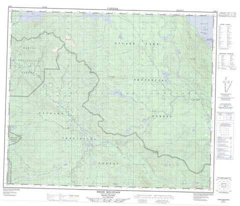
093K07 Shass Mountain Canada topo map, 1:50,000 scale
093K07 Shass Mountain NRCAN topographic map.
Includes UTM and GPS geographic coordinates (latitude and longitude). This 50k scale map is suitable for hiking, camping, and exploring, or you could frame it as a wall map.
Printed on-demand using high resolution, on heavy weight and acid free paper, or as an upgrade on a variety of synthetic materials.
Topos available on paper, Waterproof, Poly, or Tyvek. Usually shipping rolled, unless combined with other folded maps in one order.
- Product Number: NRCAN-093K07
- Parent Topo: TOPO-093K
- Map ID also known as: 093K07, 93K7, 93K07
- Unfolded Size: Approximately 26" high by 36" wide
- Weight (paper map): ca. 55 grams
- Map Type: POD NRCAN Topographic Map
- Map Scale: 1:50,000
- Geographical region: British Columbia, Canada
Neighboring Maps:
All neighboring Canadian topo maps are available for sale online at 1:50,000 scale.
Purchase the smaller scale map covering this area: Topo-093K
Spatial coverage:
Topo map sheet 093K07 Shass Mountain covers the following places:
- Kasaan Bay - Beaver Islands Indian Reserve 8 - Beaver Islands Indian Reserve 8 - Réserve indienne Beaver Islands 8 - Réserve indienne Beaver Islands 8 - Réserve indienne Shas Dzuhl Koh 35 - Shas Dzuhl Koh 35 - Shas Dzuhl Koh Indian Reserve 35 - Beaver Island - Dennee Island - Bolcome Lake - Camsell Lake - Charlotte Lake - Dawn Lake - Grassham Lake - Jenny Lake - Karena Lake - Marie Lake - McKnab Lake - Nilan Lake - Pam Lake - Stuart Lake - Sutherland Lake - Wes Lake - Mount Beals - Mount Bud - Mount Lorenz - Mount Nielsp - Peta Mountain - Shass Mountain - Regional District of Bulkley-Nechako - Interior Plateau - Nechako Plateau - Duncan Creek - Gravel Creek - Marie Creek - Nielsp Creek - Pitka Creek - Shass Creek - Shovel Creek - Sowchea Creek - Sutherland River


