
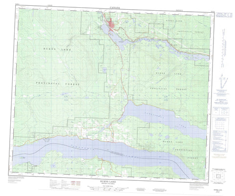
093K04 Burns Lake Canada topo map, 1:50,000 scale
093K04 Burns Lake NRCAN topographic map.
Includes UTM and GPS geographic coordinates (latitude and longitude). This 50k scale map is suitable for hiking, camping, and exploring, or you could frame it as a wall map.
Printed on-demand using high resolution, on heavy weight and acid free paper, or as an upgrade on a variety of synthetic materials.
Topos available on paper, Waterproof, Poly, or Tyvek. Usually shipping rolled, unless combined with other folded maps in one order.
- Product Number: NRCAN-093K04
- Parent Topo: TOPO-093K
- Map ID also known as: 093K04, 93K4, 93K04
- Unfolded Size: Approximately 26" high by 36" wide
- Weight (paper map): ca. 55 grams
- Map Type: POD NRCAN Topographic Map
- Map Scale: 1:50,000
- Geographical region: British Columbia, Canada
Neighboring Maps:
All neighboring Canadian topo maps are available for sale online at 1:50,000 scale.
Purchase the smaller scale map covering this area: Topo-093K
Spatial coverage:
Topo map sheet 093K04 Burns Lake covers the following places:
- Owens Bay - Burns Lake Indian Reserve 18 - Chapel Park Indian Reserve 28 - Cheslatta Indian Reserve 1 - François Lake Indian Reserve 7 - Poison Creek Indian Reserve 17 - Poison Creek Indian Reserve 17A - Réserve indienne Burns Lake 18 - Réserve indienne Chapel Park 28 - Réserve indienne Cheslatta 1 - Réserve indienne Francois Lake 7 - Réserve indienne Poison Creek 17 - Réserve indienne Poison Creek 17A - Réserve indienne Skins Lake 16A - Réserve indienne Woyenne 27 - Skins Lake Indian Reserve 16A - Woyenne Indian Reserve 27 - Gerow Island - Johns Island - John's Island - Anders Lake - Burns Lake - Conservation Lake - Crystal Lake - Decker Lake - Faber Lake - François Lake - Guyishton Lake - John Brown Lakes - Kager Lake - Loch Lomond - Maud Lake - Mulvaney Lake - Octopus Lake - Shaeffer Lake - Slug Lake - Tchesinkut Lake - Regional District of Bulkley-Nechako - Burns Lake Park - Dead Man's Island Park - Interior Plateau - Nechako Plateau - Allin Creek - Baker Creek - Beach Creek - Eagle Creek - Endako River - Evans Creek - Gerow Creek - Guyishton Creek - Sauls Creek - Sheraton Creek - Snodgrass Creek - Stearns Creek - Tatalrose Creek - Tintagel Creek - Wardrop Creek - Francois Lake - François Lake - Keefes - Southbank - Tchesinkut Lake - Tintagel - Burns Lake


