
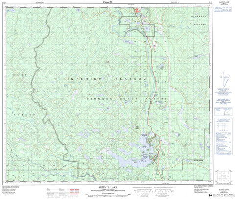
093J07 Summit Lake Canada topo map, 1:50,000 scale
093J07 Summit Lake NRCAN topographic map.
Includes UTM and GPS geographic coordinates (latitude and longitude). This 50k scale map is suitable for hiking, camping, and exploring, or you could frame it as a wall map.
Printed on-demand using high resolution, on heavy weight and acid free paper, or as an upgrade on a variety of synthetic materials.
Topos available on paper, Waterproof, Poly, or Tyvek. Usually shipping rolled, unless combined with other folded maps in one order.
- Product Number: NRCAN-093J07
- Parent Topo: TOPO-093J
- Map ID also known as: 093J07, 93J7, 93J07
- Unfolded Size: Approximately 26" high by 36" wide
- Weight (paper map): ca. 55 grams
- Map Type: POD NRCAN Topographic Map
- Map Scale: 1:50,000
- Geographical region: British Columbia, Canada
Neighboring Maps:
All neighboring Canadian topo maps are available for sale online at 1:50,000 scale.
Purchase the smaller scale map covering this area: Topo-093J
Spatial coverage:
Topo map sheet 093J07 Summit Lake covers the following places:
- Campbell Island - Corning Island - Guest Island - Huble Island - Johnson Island - Livingston Island - Loon Island - MacArthur Island - Mosquito Island - Porter Island - Adam Lake - Adrian Lake - Alford Lake - Augustine Lake - Balsam Lake - Barney Lake - Bear Lake - Beaverdam Lake - Boot Lake - Bowman Slough - Caine Lake - Cloud Lake - Cottonwood Lakes - Crystal Lake - Dominion Lake - Duck Lake - Echo Lake - Elsie Lake - Emerald Lake - Enquist Lake - Erickson Lake - Ericson Lake - Fire Lake - Fisher Lake - Hand Lake - Hart Lake - Huble Lake - Indigo Lake - Island Lake - Jakes Lake - Kingfisher Lake - Lily Lake - Little Heart Lake - Log Lake - McEwan Lake - Merton Lake - Neilsen Lake - Neilson Lake - Otter Lake - Pas Lake - Pickle Lake - Polar Mill Pond - Rush Lake - Skeleton Lake - Spade Lake - Square Lake - Squaw Lake - Sucker Lake - Summit Lake - Tang Lake - Tie Mill Lake - Twin Lake - Upper Summit Lake - Wilfs Lake - Wilson Lake - Coffeepot Mountain - Teapot Mountain - Regional District of Fraser-Fort George - Crooked River Park - Interior Plateau - Nechako Plateau - Alford Creek - Angusmac Creek - Balsam Creek - Caine Creek - Copper Creek - Crooked River - Echo Creek - Enquist Creek - Erickson Creek - Merton Creek - Miller Creek - Neilson Creek - O'Dell Creek - Salmon River - Teapot Creek - Thorpes Creek - Thorps Creek - Wilson Creek - Witters Creek - Elephant Rock - Averil - Bear Lake - Hart - Killy - McEwan - O'Dell - Summit Lake - Loon Marsh - O'Dell Swamp - Teapot Mountain Marsh - Thorpes Marsh - Thorps Marsh - Witters Marsh


