
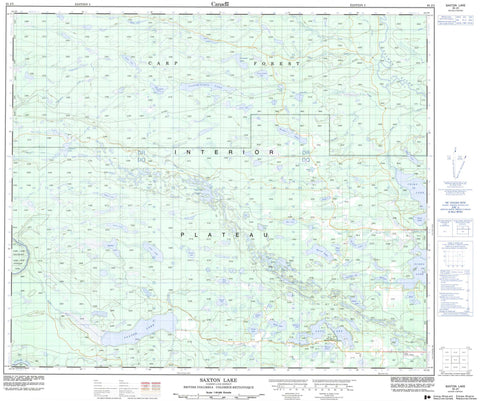
093J03 Saxton Lake Canada topo map, 1:50,000 scale
093J03 Saxton Lake NRCAN topographic map.
Includes UTM and GPS geographic coordinates (latitude and longitude). This 50k scale map is suitable for hiking, camping, and exploring, or you could frame it as a wall map.
Printed on-demand using high resolution, on heavy weight and acid free paper, or as an upgrade on a variety of synthetic materials.
Topos available on paper, Waterproof, Poly, or Tyvek. Usually shipping rolled, unless combined with other folded maps in one order.
- Product Number: NRCAN-093J03
- Parent Topo: TOPO-093J
- Map ID also known as: 093J03, 93J3, 93J03
- Unfolded Size: Approximately 26" high by 36" wide
- Weight (paper map): ca. 55 grams
- Map Type: POD NRCAN Topographic Map
- Map Scale: 1:50,000
- Geographical region: British Columbia, Canada
Neighboring Maps:
All neighboring Canadian topo maps are available for sale online at 1:50,000 scale.
Purchase the smaller scale map covering this area: Topo-093J
Spatial coverage:
Topo map sheet 093J03 Saxton Lake covers the following places:
- Bolarn Lake - Boquist Lake - Bow Lake - Brûlé Lake - Butterfly Lake - Byers Lake - Camp Lake - Chief Lake - Circle Lake - Clauminchil Lake - Clover Lake - Crescent Lake - Darby Lake - Docs Lake - Edna Lake - Eena Lake - Erickson Lake - Fire Lake - Flat Lake - Germaine Lake - Green Timber Lake - Heron Lake - Hidden Lake - Hoodoo Lake - Hoodoo Lakes - Kathie Lake - Kaykay Lake - Little Murch Lake - Loup Garou Lake - Meadow Lake - Mollie Lake - Murch Lake - Murtle Lake - Mytting Lake - Ness Lake - Nicholl Lake - Nukko Lake - Obert Lake - Ring Lake - Saxton Lake - Seaman Lake - Shamrock Lake - Shell Lake - Spence Lake - Steele Lake - Sylvan Lake - Taginchil Lake - Upper Clauminchil Lake - Verdant Lake - Vivian Lake - Windsor Lake - Regional District of Bulkley-Nechako - Regional District of Fraser-Fort George - Eskers Park - Ness Lake Park - Interior Plateau - Nechako Plateau - Chinohchey Creek - Crocker Creek - Docs Creek - Gravel Creek - Hoodoo Creek - Mandalay Creek - Nechako River - Nukko Creek - Salmon River - Saxton Creek - Shell Creek - Stuart River - Taginchil Creek - West Creek - Youngs Creek - Sylvan Glade


