
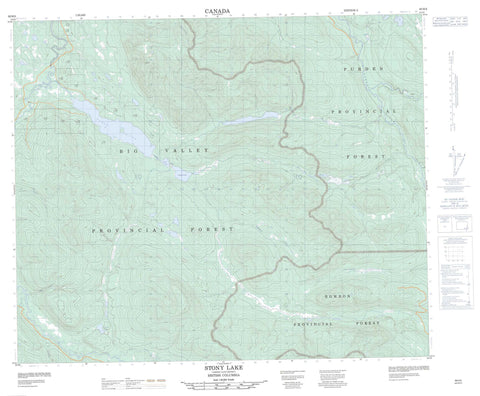
093H05 Stony Lake Canada topo map, 1:50,000 scale
093H05 Stony Lake NRCAN topographic map.
Includes UTM and GPS geographic coordinates (latitude and longitude). This 50k scale map is suitable for hiking, camping, and exploring, or you could frame it as a wall map.
Printed on-demand using high resolution, on heavy weight and acid free paper, or as an upgrade on a variety of synthetic materials.
Topos available on paper, Waterproof, Poly, or Tyvek. Usually shipping rolled, unless combined with other folded maps in one order.
- Product Number: NRCAN-093H05
- Parent Topo: TOPO-093H
- Map ID also known as: 093H05, 93H5, 93H05
- Unfolded Size: Approximately 26" high by 36" wide
- Weight (paper map): ca. 55 grams
- Map Type: POD NRCAN Topographic Map
- Map Scale: 1:50,000
- Geographical region: British Columbia, Canada
Neighboring Maps:
All neighboring Canadian topo maps are available for sale online at 1:50,000 scale.
Purchase the smaller scale map covering this area: Topo-093H
Spatial coverage:
Topo map sheet 093H05 Stony Lake covers the following places:
- Bonner Lake - Cameron Lake - Crescent Lake - Davids Lake - Dillabough Lake - Fourteen Mile Lake - Haggen Lakes - Ketcham Lake - McDonald Lake - Rond Lake - Slender Lake - Stephen Lake - Stony Lake - Cariboo Regional District - Fraser Plateau - Interior Plateau - Big Valley Creek - Boyce Creek - Deadtimber Creek - Eighteen Mile Creek - Fourteen Mile Creek - Indianpoint Creek - Ketcham Creek - Narrowlake Creek - Nitaga Creek - Paput Creek - Rebman Creek - Rond Creek - Slender Creek - Stephanie Creek - Towkuh Creek - Willow River


