
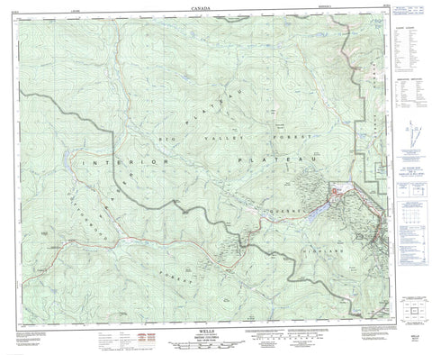
093H04 Wells Canada topo map, 1:50,000 scale
093H04 Wells NRCAN topographic map.
Includes UTM and GPS geographic coordinates (latitude and longitude). This 50k scale map is suitable for hiking, camping, and exploring, or you could frame it as a wall map.
Printed on-demand using high resolution, on heavy weight and acid free paper, or as an upgrade on a variety of synthetic materials.
Topos available on paper, Waterproof, Poly, or Tyvek. Usually shipping rolled, unless combined with other folded maps in one order.
- Product Number: NRCAN-093H04
- Parent Topo: TOPO-093H
- Map ID also known as: 093H04, 93H4, 93H04
- Unfolded Size: Approximately 26" high by 36" wide
- Weight (paper map): ca. 55 grams
- Map Type: POD NRCAN Topographic Map
- Map Scale: 1:50,000
- Geographical region: British Columbia, Canada
Neighboring Maps:
All neighboring Canadian topo maps are available for sale online at 1:50,000 scale.
Purchase the smaller scale map covering this area: Topo-093H
Spatial coverage:
Topo map sheet 093H04 Wells covers the following places:
- Wells - Abbott Lake - Black Lake - Bonner Lake - Brough Lake - Cornish Lake - Eight Mile Lake - Ella Lake - Four Mile Lake - Fourmile Lake - Groundhog Lake - Jack of Clubs Lake - Lottie Lake - Nine Mile Lake - Ninemile Lake - Tucker Lake - Westpass Lake - Wingdam Lake - Yuzkli Lake - Bald Mountain - Barkerville Mountain - Cornish Mountain - Cow Mountain - Dragon Mountain - Eaglenest Mountain - Elk Mountain - Grub Mountain - Hardscrabble Mountain - Island Mountain - Milk Ranch Mountain - Mount Agnes - Mount Amador - Mount Anderson - Mount Burns - Mount Nelson - Mount Pinkerton - Mount Proserpine - Mount Tom - Mount Van Winkle - Mount Wiley - Nelson Mountain - Nelsons Mountain - Pinegrove Mountain - Quesnel Highland - Richfield Mountain - Sovereign Mountain - Two Sisters Mountain - Valley Mountain - Cariboo Regional District - Barkerville Historic Park - Barkerville Historic Town - Barkerville Park - Blessing's Grave - Blessing's Grave Park - Wendle Park - Fraser Plateau - Interior Plateau - Agnus Creek - Albrecht Creek - Alces Creek - Alex Allan Creek - Alexallan Creek - Amador Creek - Anderson Creek - Archer Creek - Aura Fina Creek - Baldhead Creek - Barry Creek - Bassford Creek - Beaverpass Creek - Big Valley Creek - Brough Creek - Burns Creek - Café Creek - Campbell Creek - Canyon Creek - Carruthers Creek - Channel Creek - Chisholm Creek - Cooper Creek - Cornish Creek - Coulter Creek - Davis Creek - Deadtimber Creek - Devils Lake Creek - Dilman Creek - Donovan Creek - Downey Creek - Dragon Creek - Dyhrman Creek - Eight Mile Creek - Eight Mile Lake Creek - Eskridge Creek - Everton Creek - Florrie Creek - Forty Thieves Creek - Forward Creek - Foster Creek - Fourteen Mile Creek - Hardscrabble Creek - Heyde Creek - Hogshead Creek - Houseman Creek - Hyde Creek - Jack of Clubs Creek - Jawbone Creek - John Boyd Creek - Julius Creek - Kee Khan Creek - Kwong Foo Creek - Last Chance Creek - Lightning Creek - Lottie Creek - Lovett Creek - Lowhee Creek - Lunch Creek - Magnus Creek - Mailleue Creek - Martins Creek - Mary Creek - Mask Creek - Mathers Creek - McClarty Creek - McLellan Gulch - Meadows Creek - Milk Ranch Pass Creek - Montgomery Creek - Mosquito Creek - Mostique Creek - Moustique Creek - Mustang Creek - Nelsons Creek - New Creek - Nine Mile Creek - Norwood Creek - Olally Creek - Opitsah Creek - Peep O'Day Creek - Peters Creek - Pinegrove Creek - Pinkerton Creek - Pinus Creek - Plus Creek - Porcepic Creek - Promise Creek - Pundata Creek - Queen of Clubs Creek - Ramos Creek - Rucheon Creek - Sams Creek - Sawmill Creek - Shepherd Creek - Slade Creek - Slate Creek - Sleepy Creek - Slough Creek - South Yuzkli Creek - Sovereign Creek - Stewart Creek - Stoney Creek - Sugar Creek - Summit Creek - Sundberg Creek - Telluride Creek - Timon Creek - Tom Creek - Tregillus Creek - Two Bit Creek - Two Sisters Creek - Valley Creek - Van Winkle Creek - Victoire Creek - Walker Gulch - West Creek - Wiley Creek - Williams Creek - Willow River - Wilsons Creek - Wingdam Creek - Wormwold Creek - Yuzkli Creek - Barkerville - Beaver Pass House - Fairfield - Pinegrove - Stanley - Van Winkle - Wells - Wingdam - Beaver Pass - Black Jack Gulch - Boulder Gulch - Break O'Day Gulch - Clothier Gulch - Conklin Gulch - Devils Canyon - Downey Pass - Dryup Gulch - Emory Gulch - Eureka Gulch - Grub Gulch - Hobo Gulch - Island Gulch - Lake Gulch - Larsen Gulch - McArthur Gulch - McCallum Gulch - McLennan Gulch - Mink Gulch - Mugford Gulch - Oregon Gulch - Peep o'Day Gulch - Perkins Gulch - Quartz Ravine - Red Gulch - Shamrock Gulch - Stephen Gulch - Stevens Gulch - Stouts Gulch - Urquhart Gulch - Watsons Gulch - Westcreek Pass - Whipsaw Gulch


